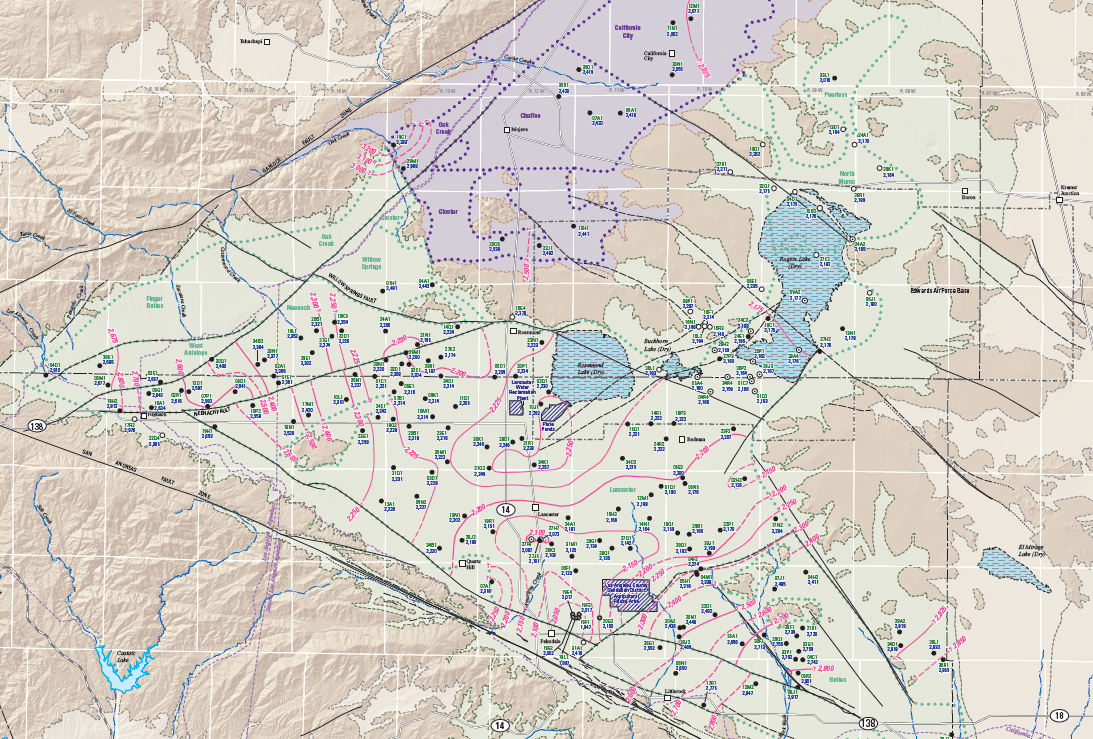
Water-Level Studies in the Antelope Valley and Fremont Valley Groundwater Basins
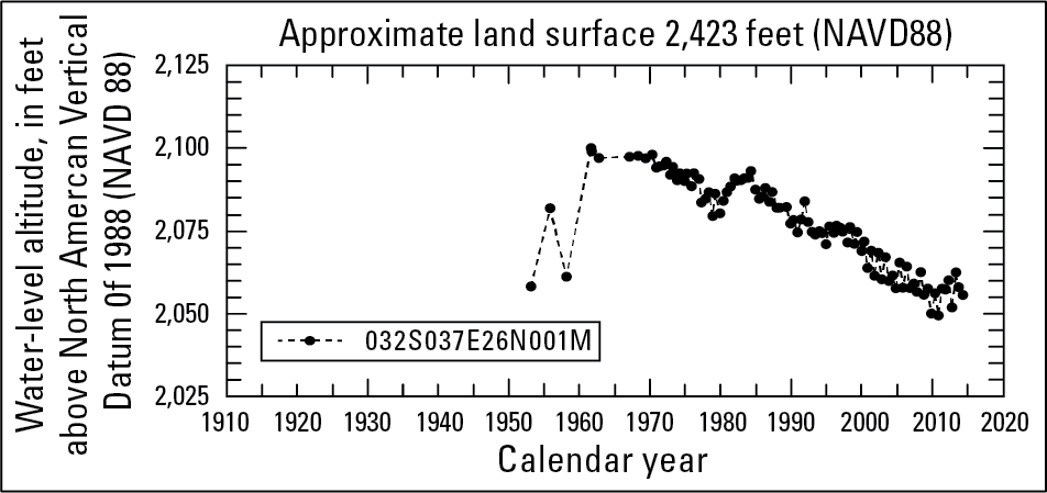
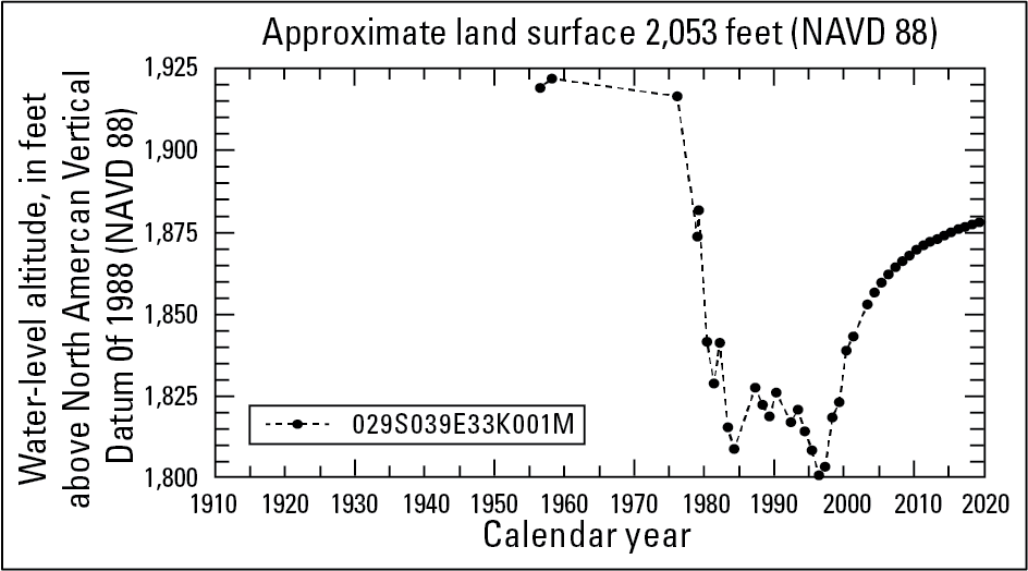
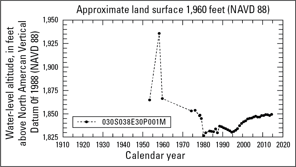
Antelope Valley and Fremont Valley Hydrographs
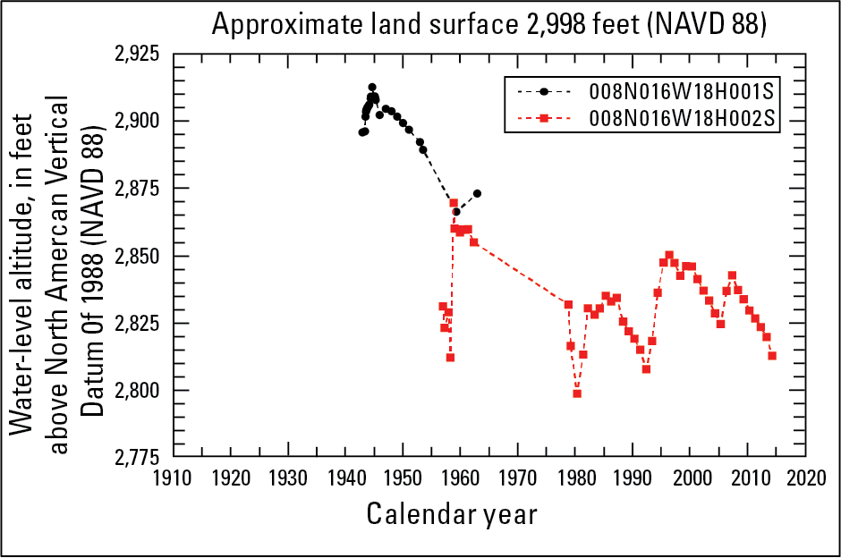
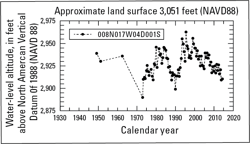
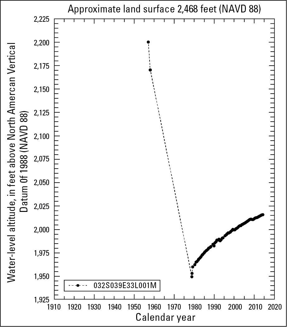
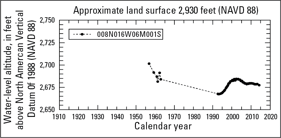
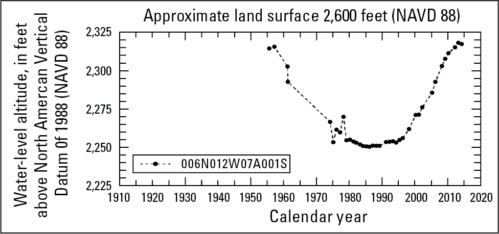
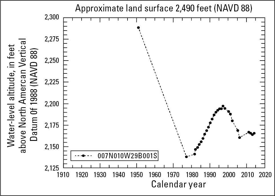
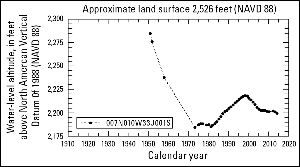
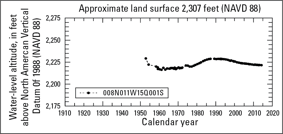
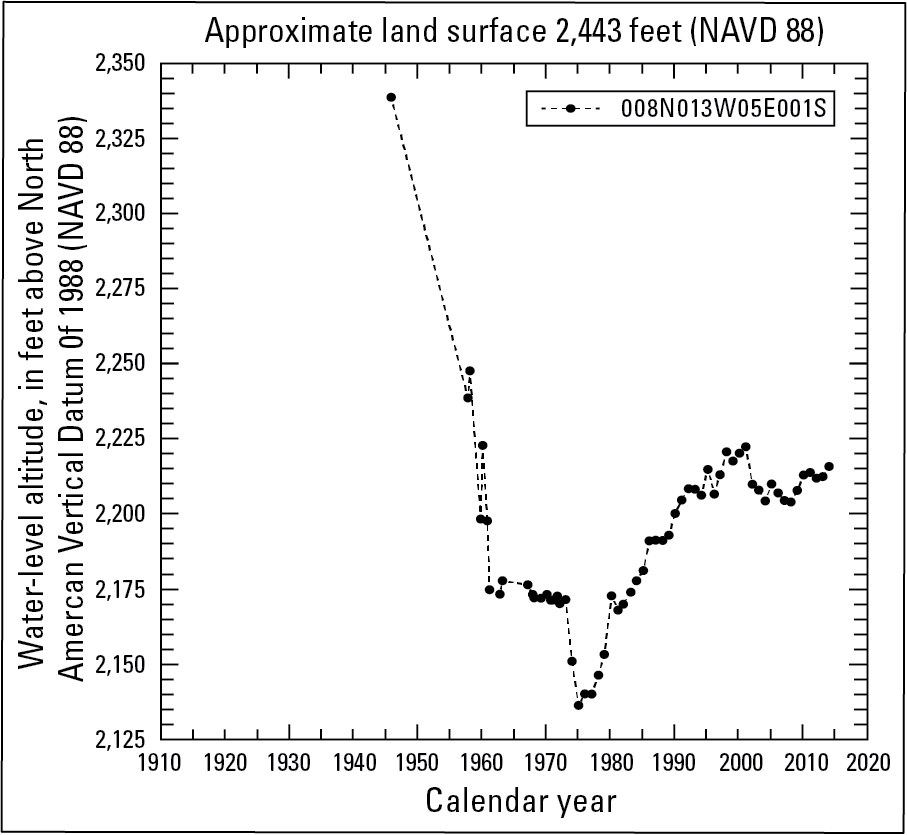
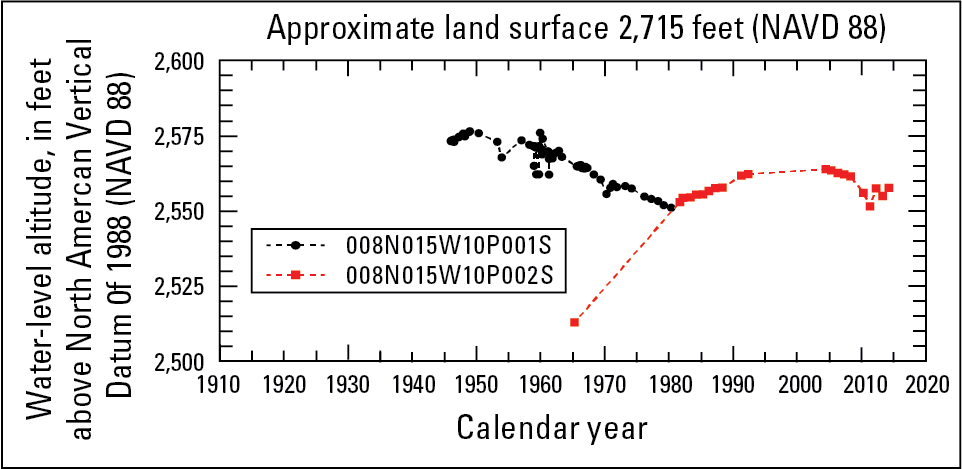
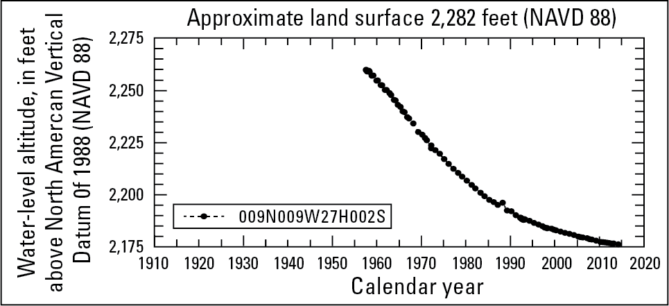
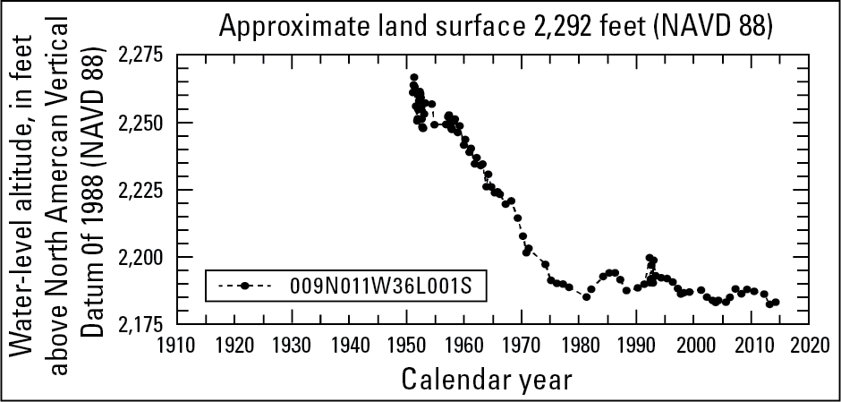
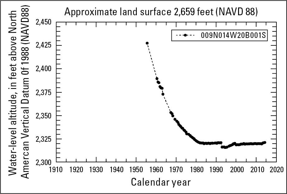
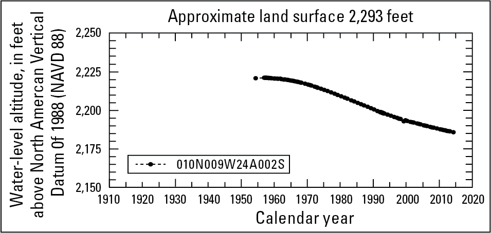
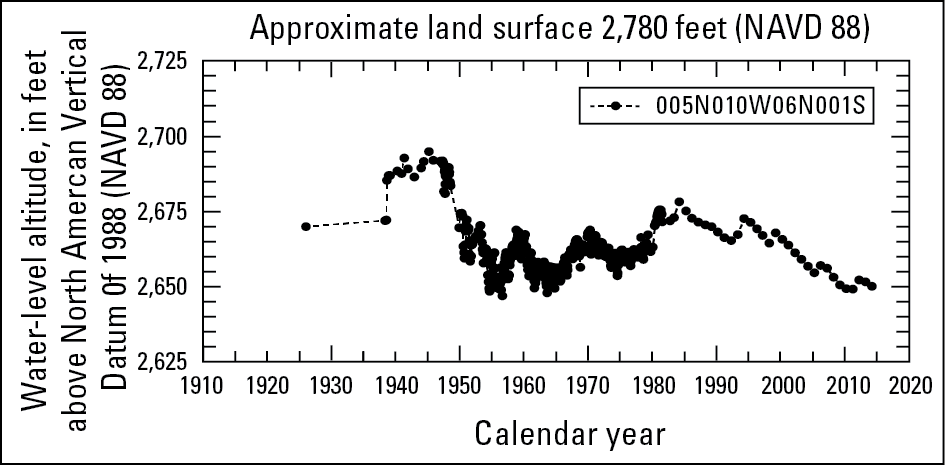
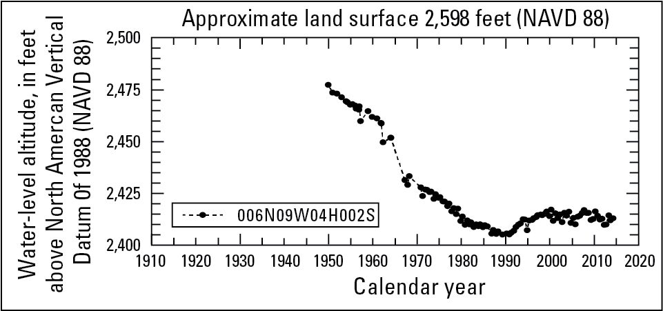
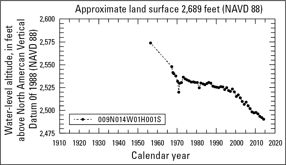
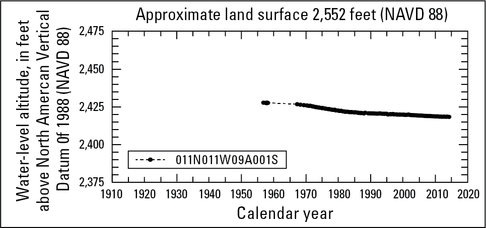
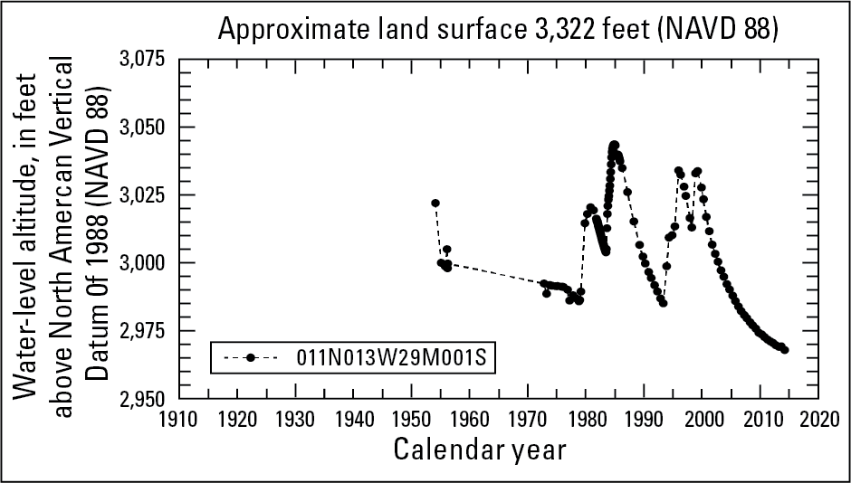
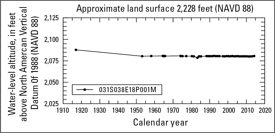
Historical water-level data from the National Water Information System (NWIS) database were used in conjunction with data collected from 33 wells to construct 31 water-level hydrographs to show long-term (1917-2014) water-level changes in selected areas of the Antelope Valley and Fremont Valley groundwater basins. The Antelope Valley groundwater basin encompasses nine groundwater subbasins and parts of two groundwater subbasins and the Fremont Valley groundwater basin encompasses three groundwater subbasins and parts of two groundwater subbasins. In some of these groundwater subbasins, data from more than one well were combined on a hydrographs to show water-level changes throughout longer periods. Combining data from multiple wells onto a single hydrograph was done when a well was no longer accessible or went dry due to a decline in the water table; data from a well in close proximity was used to continue the record. Well-construction data for the wells were inspected and compared to ensure that the wells were measuring water levels from the same aquifer. Data from the different wells are shown using different colors on the hydrographs.
A hydrograph shows a period of record for a well. Symbols indicate actual data values from the USGS National Water Information System (NWIS). Multiple colors indicate two or more wells usedto display long-term water-level trends.
Finger Buttes Subbasin
Peerless Subbasin
West Antelope Subbasin
Lancaster Subbasin
Pearland Subbasin
Buttes Subbasin
Willow Springs Subbasin
Chaffee Subbasin
Gloster Subbasin

Oak Creek Subbasin
Stakeholders
Antelope Valley State Water Contractors Association (AVSWCA)
Contacts
Project Chief:
Meghan Dick
Hydrologist
USGS California Water Science Center
4165 Spruance Rd. Ste 200
San Diego, CA 92101
Office: 619-225-6154
Maps
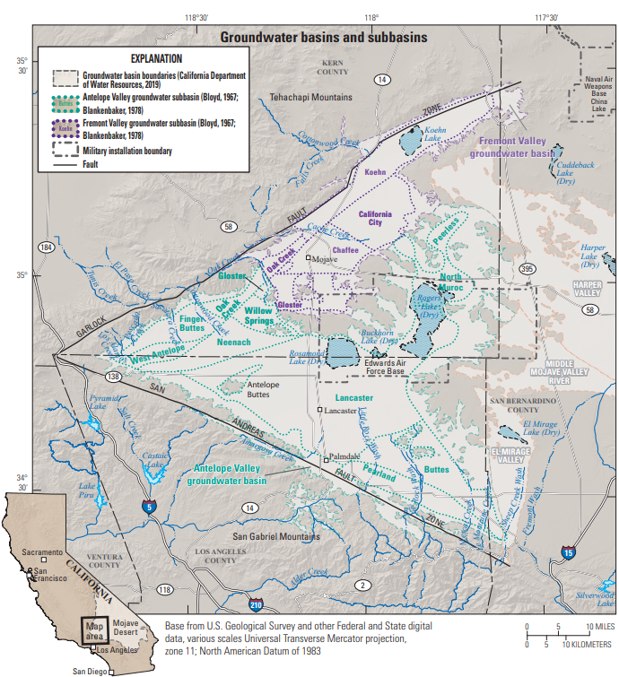
Antelope & Fremont Valleys: Detailed Basin Map
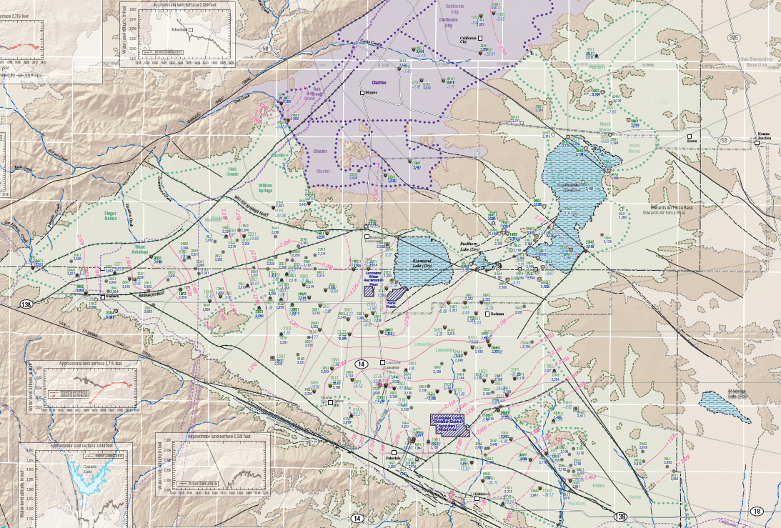
Antelope Valley Water-Level Contours
Antelope Valley Water-Level Changes