Water-Level Studies in the Antelope Valley and Fremont Valley Groundwater Basins
Antelope Valley and Fremont Valley Datasets
Water-level Data Downloads
| 2014 | 1996-2014 |
|---|---|
| Water-level Site Data | Water-level Change Data |
| Contours |
Hydrographs
USGS National Water Information System (NWIS) Water Data for California
http://waterdata.usgs.gov/ca/nwis
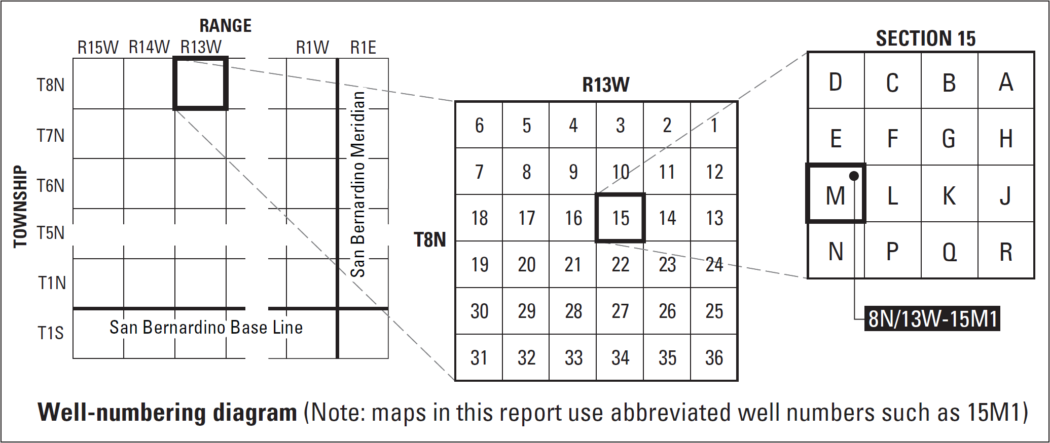
Well-Numbering System
Wells are identified and numbered according to their location in the rectangular system for the subdivision of public lands. Identification consists of the township number, north or south; the range number, east or west; and the section number. Each section is divided into sixteen 40-acre tracts lettered consecutively (except I and O), beginning with “A” in the northeast corner of the section and progressing in a sinusoidal manner to “R” in the southeast corner. Within the 40-acre tract, wells are sequentially numbered in the order they are inventoried. The final letter refers to the base line and meridian. In California, there are three base lines and meridians; Humboldt (H), Mount Diablo (M), and San Bernardino (S). Well numbers consist of 15 characters and follow the format 008N013W15M001S. Wells in the same township and range are referred to only by their section designation, 15M1. The following diagram shows how the number for well 8N/13W-15M1 is derived.
Stakeholders
Antelope Valley State Water Contractors Association (AVSWCA)
Contacts
Project Chief:
Meghan Dick
Hydrologist
USGS California Water Science Center
4165 Spruance Rd. Ste 200
San Diego, CA 92101
Office: 619-225-6154
Maps
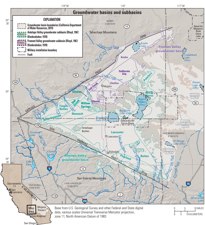
Antelope & Fremont Valleys: Detailed Basin Map
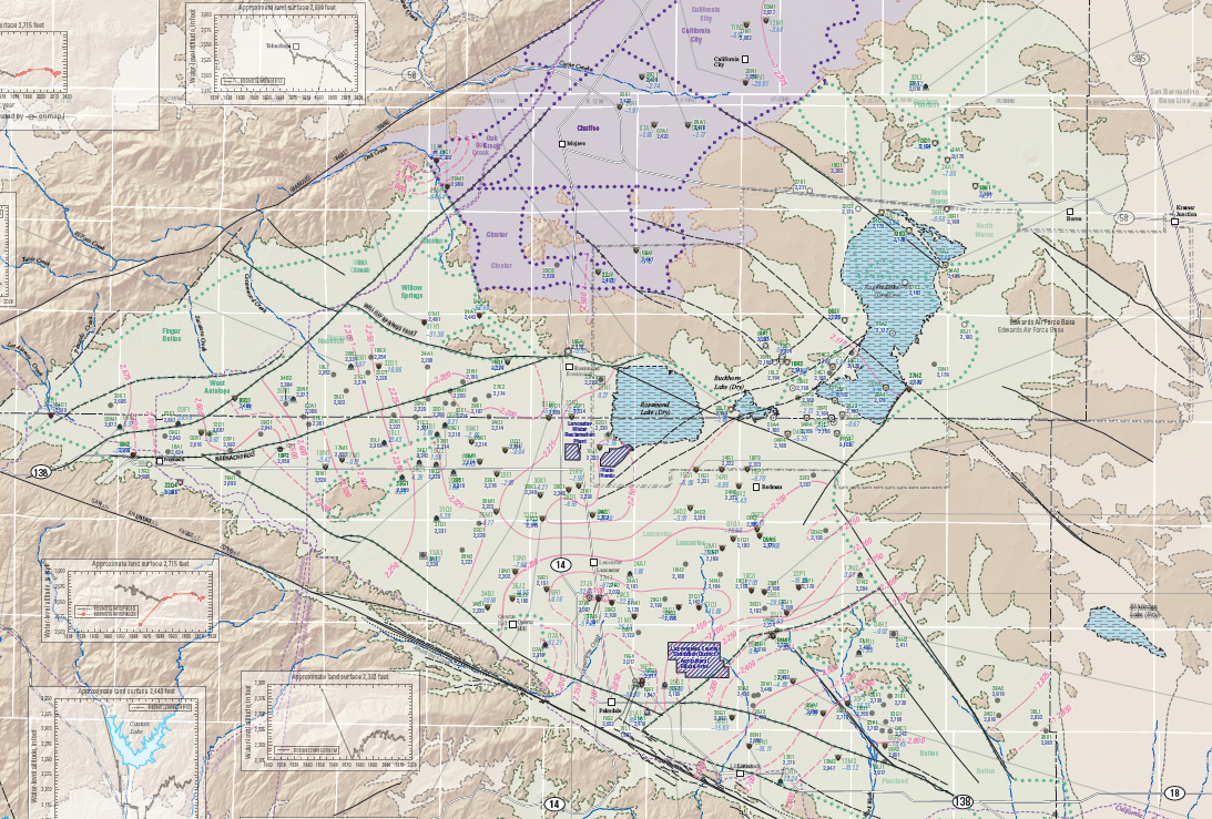
Antelope Valley Water-Level Contours
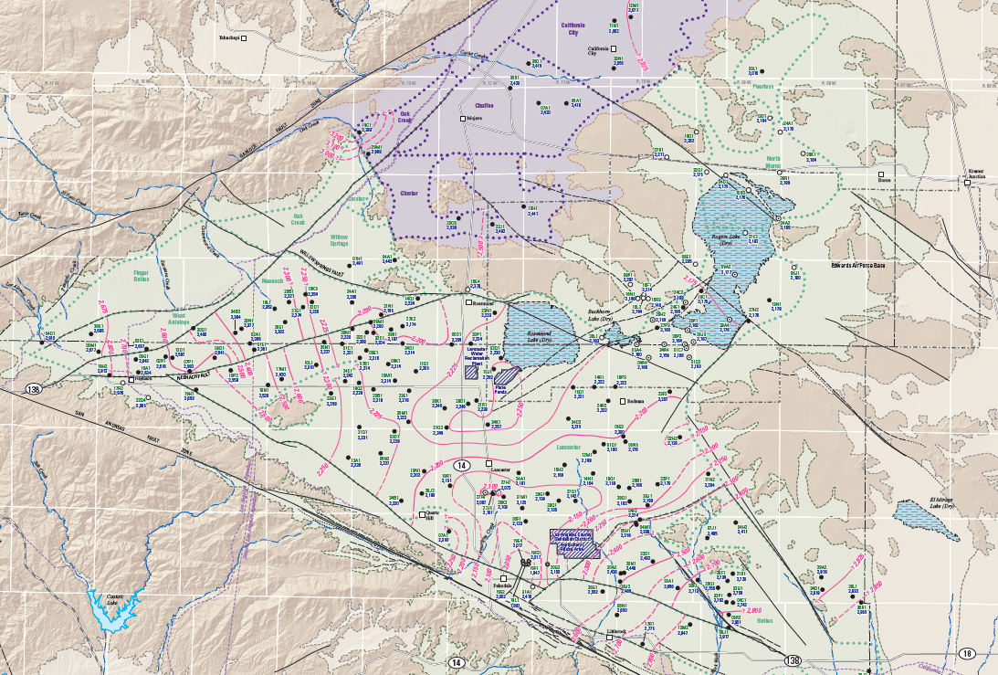
Antelope Valley Water-Level Changes