

USGS California Wildfire Resources
California Wildfire & Water Multimedia Gallery
Images
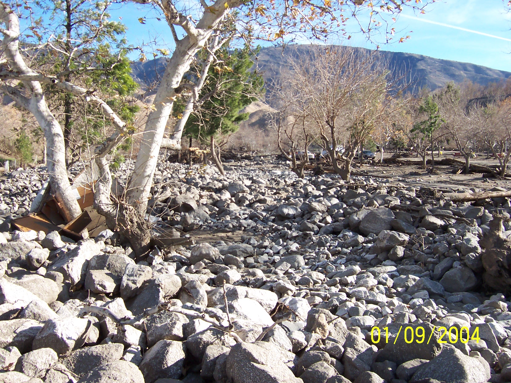
Post-fire debris flow
Debris Flow in Cable Canyon following the 2003 Old Fire in the San Bernardino Mountains, California.
Video
Post-wildfire Flood and Debris Flow: 2014 Silverado Fire
In 2014, the Silverado Fire burned approximately 4 km^2 in Orange County, California. After the fire, the USGS installed an automated rain-triggered camera to monitor post-wildfire flooding and debris flow at the outlet of a small 0.6 km^2 basin within the burn area. This video shows the initial surge and peak flow triggered by an intense rainstorm on July 19, 2015. The peak flow occured about 3 minutes after the intial surge.
Date Taken: July 19, 2015
Location Taken: Orange County, CA, US
Videographer: Jason Kean, U.S. Geological Survey, jwkean@usgs.gov
Video Credits: Joel Smith, Dennis Staley, Francis Rengers, and Luke McGuire
Dirk Kempthorne Visits Malibu, California 2008
Secretary of the Interior, Dirk Kempthorne, visits the fire ravaged Malibu, California (Jan 14, 2008). Led by USGS scientists, the Secretary was shown how technology and collaborative science are crucial to addressing a number of post-fire threats and concerns.
- 3-D imaging to help quantify the post-fire debris flow threat.
- NOAA's "Smart-R" mobile Doppler Radar truck
- Winter Canyon Drainage - Deployment site of post-fire debris flow monitoring instruments.
- Malibu Creek - Site of USGS gaging station.
Date Taken: January 22, 2008
Location Taken: Malibu, CA, US
Videographer: Stephen M. Wessells, U.S. Geological Survey, swessells@usgs.gov
USGS and California Wildfires: Post Fire Debris Flow (part 1)
Jim Bowers, USGS, California Hydrologic Monitoring Program Chief, talks about an historic streamflow site that was buried by debris flows as a result of the 2003 fires.
Date Taken: December 30, 2007
Location Taken: San Bernardino (East Twin Creek near Arrowhead Springs), CA, US
Videographer: Stephen M. Wessells, U.S. Geological Survey, swessells@usgs.gov
USGS and California Wildfires: Post Fire Debris Flow (part 2)
Jim Bowers, USGS, California Hydrologic Monitoring Program Chief talks about the potential for debris flows in central Orange County, Modjeska Canyon, as a result of the 2007 fires.
Date Taken: December 30, 2007
Location Taken: Modjeska Canyon, CA, US
Videographer: Stephen M. Wessells, U.S. Geological Survey, swessells@usgs.gov
USGS California Wildfire & Water Publications

Loading...