
Multimedia Gallery
Video

High Stream Flow at Cajon Creek, San Bernardino County, California
Crews from the CAWSC Redlands Field Office waded into the Cajon Creek in San Bernardino County on January 12, 2017, which was flowing very rapidly, to collect streamflow measurements.
Evaluation of the occurrence of natural and anthropogenic chromium in groundwater near the mapped PG&E chromium contamination plume near Hinkley, CA.
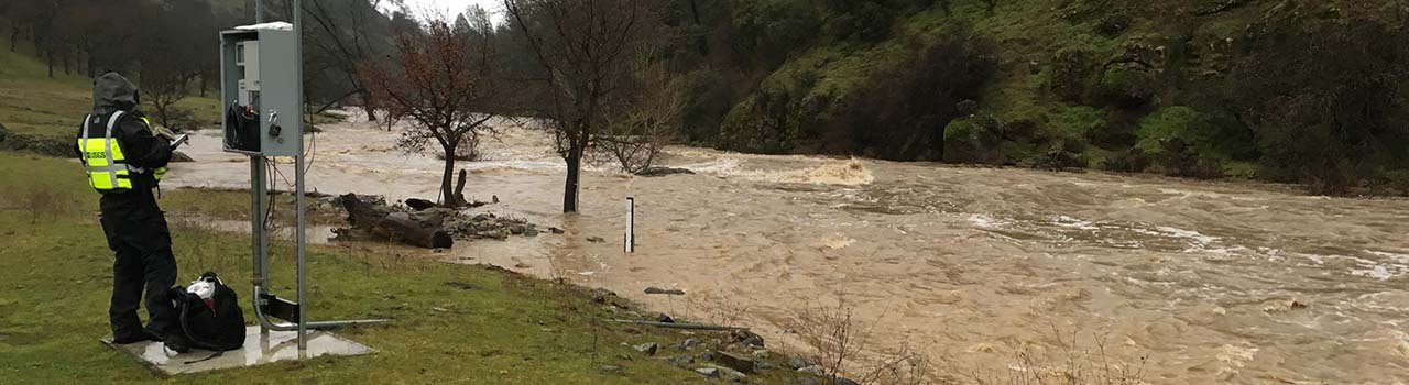
Southern California Flood Wave Captured by USGS Hydrologic Technicians
USGS Hydrologic Technicians, Drew Gaffney and Ernie Houston, captured a frontal wave during a flash flood just as it reached USGS streamgage 11136800 at Cuyama River below Buckhorn Canyon near Santa Maria, CA on July 20, 2015.
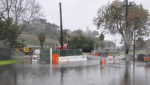
USGS stream monitoring during storms
USGS crews were in the field checking streamflow during the mid-January storms in California.
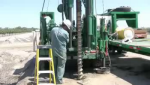
New monitoring wells for San Joaquin River Restoration Program
The US Geological Survey has begun drilling monitoring wells as part of the San Joaquin River Restoration Program.
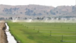
Central Valley groundwater study
USGS hydrologist Dr. Claudia Faunt discusses her new report on Central Valley groundwater.
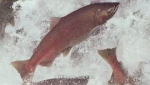
Juvenile salmon tracking study
U.S. Geological Survey (USGS) scientists are releasing thousands of tagged juvenile salmon into the Sacramento River.
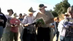
Twenty-four teachers from throughout Northern California spent a "day in the Delta" with USGS scientists.
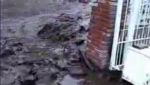
2003 debris flow in Devore, CA
Rare footage of debris flow was captured by resident Howard Davis as mud and boulders rolled down the street.
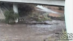
USGS Webcam captures images of flash flood
Sudden and torrential rainfall on hillsides left bare by last fall's wildfires caused dangerous flash flooding.
Webcams

Eel River at Fernbridge
Streamgage ID: 11479560
This station provides continuous monitoring of river stage.

San Lorenzo River at Big Trees State Park
Streamgage ID: 11160500
This station provides continuous monitoring of certain river conditions such as flow and stage.

Merced River at Happy Isles near Yosemite
Streamgage ID: 11264500
This station provides continuous monitoring of certain river conditions such as flow and stage.
Public Affairs Staff
Laurel Rogers
Outreach and Special Events
(619) 225-6104
cell: (619) 980-6527
Gabriel Lopez
Requests for USGS data and reports
(916) 278-3026
National USGS Multimedia Resources
Maps, Imagery and Publications