
This live webcam is currently undergoing maintenance and will be back up and running in mid-August.
Webcams
Webcams have been installed at several real-time streamgaging sites. The webcams provide valuable information to the National Weather Service, emergency managers, and area residents to evaluate real-time conditions in river environments during storms. The visual record of flooding and other river events also provides valuable research data for the USGS.
Webcam Santa Ana River at Prado - Currently Under Maintenance
This live webcam is currently undergoing maintenance and will be back up and running in mid-August.
Suisun Bay at Channel Marker 24A near Bay Point
A wide-angle view overlooking Suisun Bay at Channel Marker 24A near Bay Point, California.
A wide-angle view overlooking Suisun Bay at Channel Marker 24A near Bay Point, California.

Truckee River at Boca Bridge near Truckee, CA
This webcam is situated with streamgage 10344505 in Nevada County, CA. This station provides continuous monitoring of flow and stage. To see the streamgage data, please visit https://waterdata.usgs.gov/monitoring-location/10344505/.
This webcam is situated with streamgage 10344505 in Nevada County, CA. This station provides continuous monitoring of flow and stage. To see the streamgage data, please visit https://waterdata.usgs.gov/monitoring-location/10344505/.

Suisan Bay near Bay Point, CA
This webcam is located at monitoring station 380318121571501 (SUISUN BAY A CHANNEL MARKER 24A NR BAY POINT CA) in the Sacramento-San Joaquin Delta. The site collects water quality parameters such as salinity, specific conductance, temperature, and turbidity, as well as water velocity measurements.
This webcam is located at monitoring station 380318121571501 (SUISUN BAY A CHANNEL MARKER 24A NR BAY POINT CA) in the Sacramento-San Joaquin Delta. The site collects water quality parameters such as salinity, specific conductance, temperature, and turbidity, as well as water velocity measurements.

False River near Oakley, CA
This station is collaboratively operated by the US Geological Survey (USGS) and the CA Department of Water Resources (CADWR). USGS collects surface water data and CADWR collects water quality data.
This station is collaboratively operated by the US Geological Survey (USGS) and the CA Department of Water Resources (CADWR). USGS collects surface water data and CADWR collects water quality data.

San Lorenzo River at Big Trees State Park, CA
This webcam is located at USGS streamgage 11160500 on San Lorenzo River at Big Trees State Park. This station provides continuous monitoring of river stage.
This webcam is located at USGS streamgage 11160500 on San Lorenzo River at Big Trees State Park. This station provides continuous monitoring of river stage.

Eel River at Fernbridge, CA
This webcam is located at USGS streamgage 11479560 Eel River at Fernbridge. This station provides continuous monitoring of river stage.
This webcam is located at USGS streamgage 11479560 Eel River at Fernbridge. This station provides continuous monitoring of river stage.
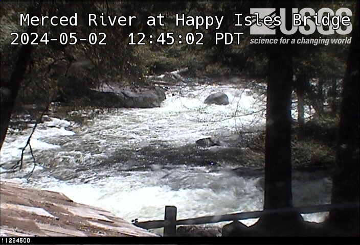
Merced River at Happy Isles Bridge, Yosemite, CA
This webcam is located at the USGS stream-gaging station on MERCED R A HAPPY ISLES BRIDGE NR YOSEMITE. This station provides continuous monitoring of certain river conditions such as flow and stage.
This webcam is located at the USGS stream-gaging station on MERCED R A HAPPY ISLES BRIDGE NR YOSEMITE. This station provides continuous monitoring of certain river conditions such as flow and stage.