San Diego Hydrogeology
San Diego Hydrology Project
The first comprehensive geologic and hydrologic study for the San Diego area, California. This study will provide the integrated hydrogeologic knowledge necessary in this important and highly visible area of the United States and will serve as a role model for similar coastal settings throughout the world that have modest rainfall and small aquifers. Locally, results will help state and federal agencies, water purveyors, and consultants to understand the local surface-water, groundwater, and biologic resources and how these resources interact with each other, and to critique ideas and opportunities for additional groundwater development.
Two primary objectives
- Develop an integrated, comprehensive understanding of the geology and hydrology of the San Diego area, focusing on the San Diego Formation and the overlying alluvial deposits.
- Use this understanding to evaluate expanded use of the alluvial deposits and the San Diego Formation for recharge and extraction.
Study area
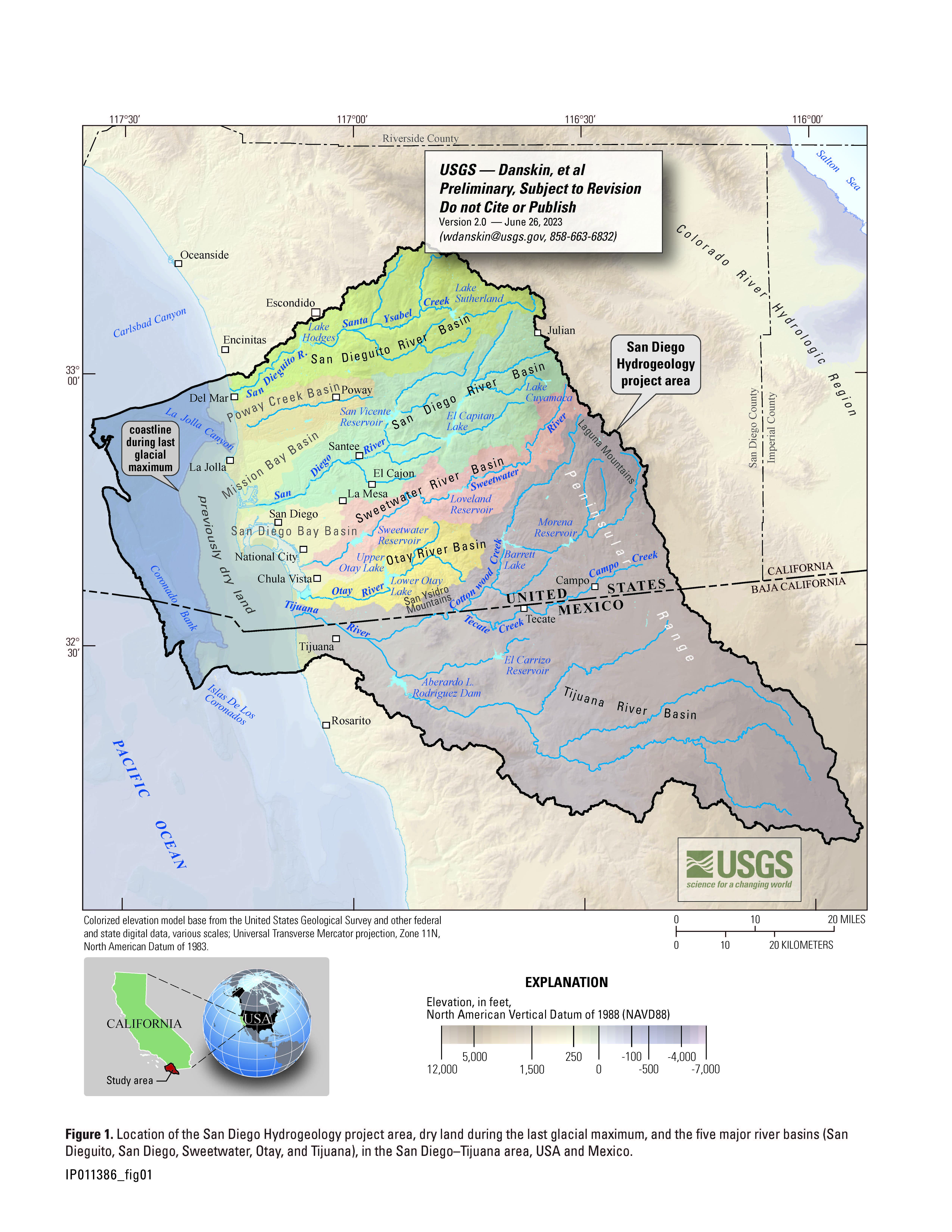
Click on image for larger view
Project Chief: Wes Danskin
Phone: 619-225-6132
Email: wdanskin@usgs.gov
Welcome to the United States Geological Survey (USGS) San Diego Hydrogeology (SDH) project website, which provides geologic and hydrologic information for the transboundary San Diego–Tijuana area, USA and Mexico. This website provides background information about the project; a variety of news items; a large amount of data, in particular for USGS multiple-depth, monitoring-well sites; geologic and hydrologic models; and additional resources including photos, illustrations, and references.
Last updated: July 2023.
Some additional data may be available from the USGS database National Water Information System (NWIS).
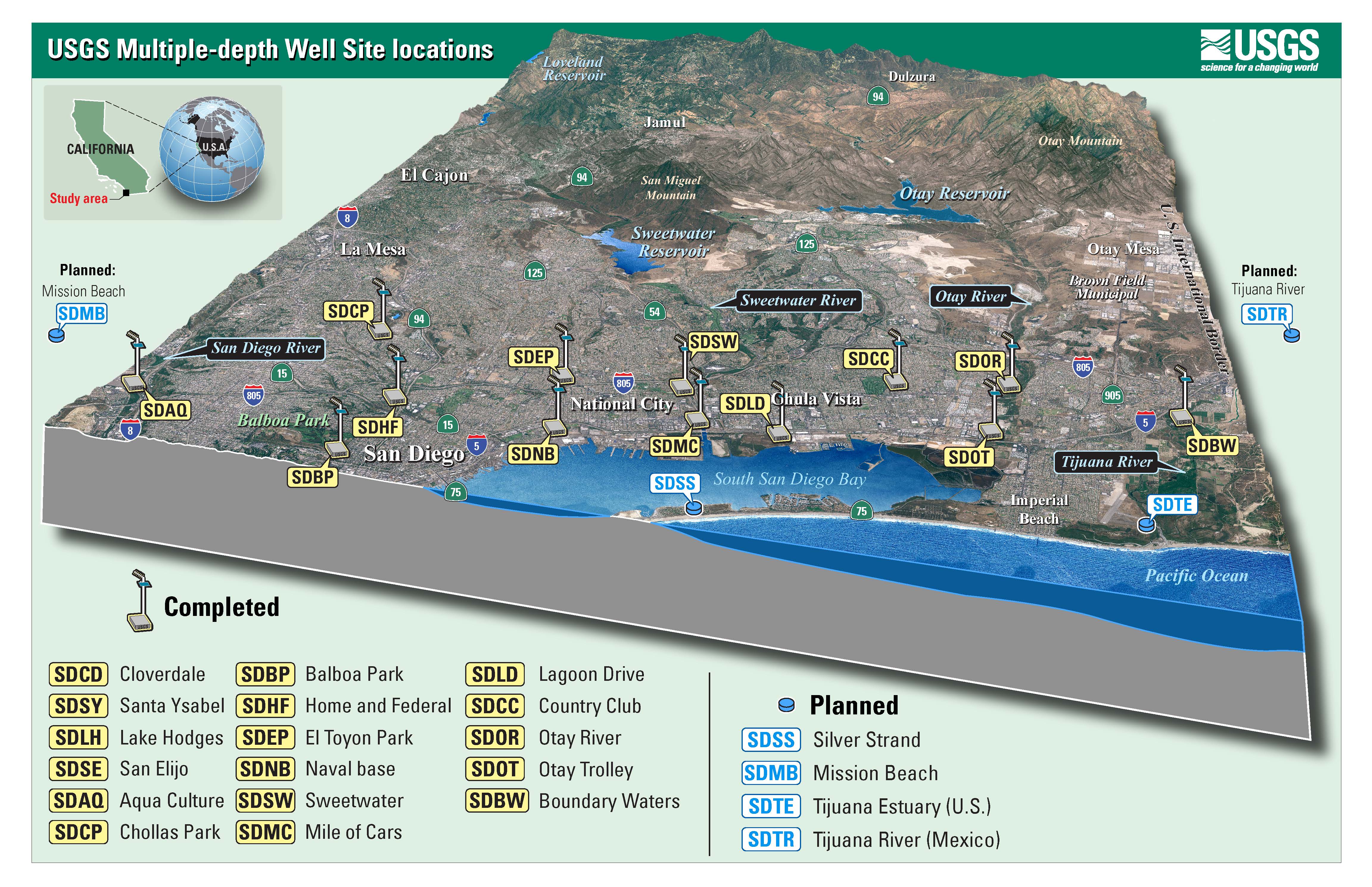
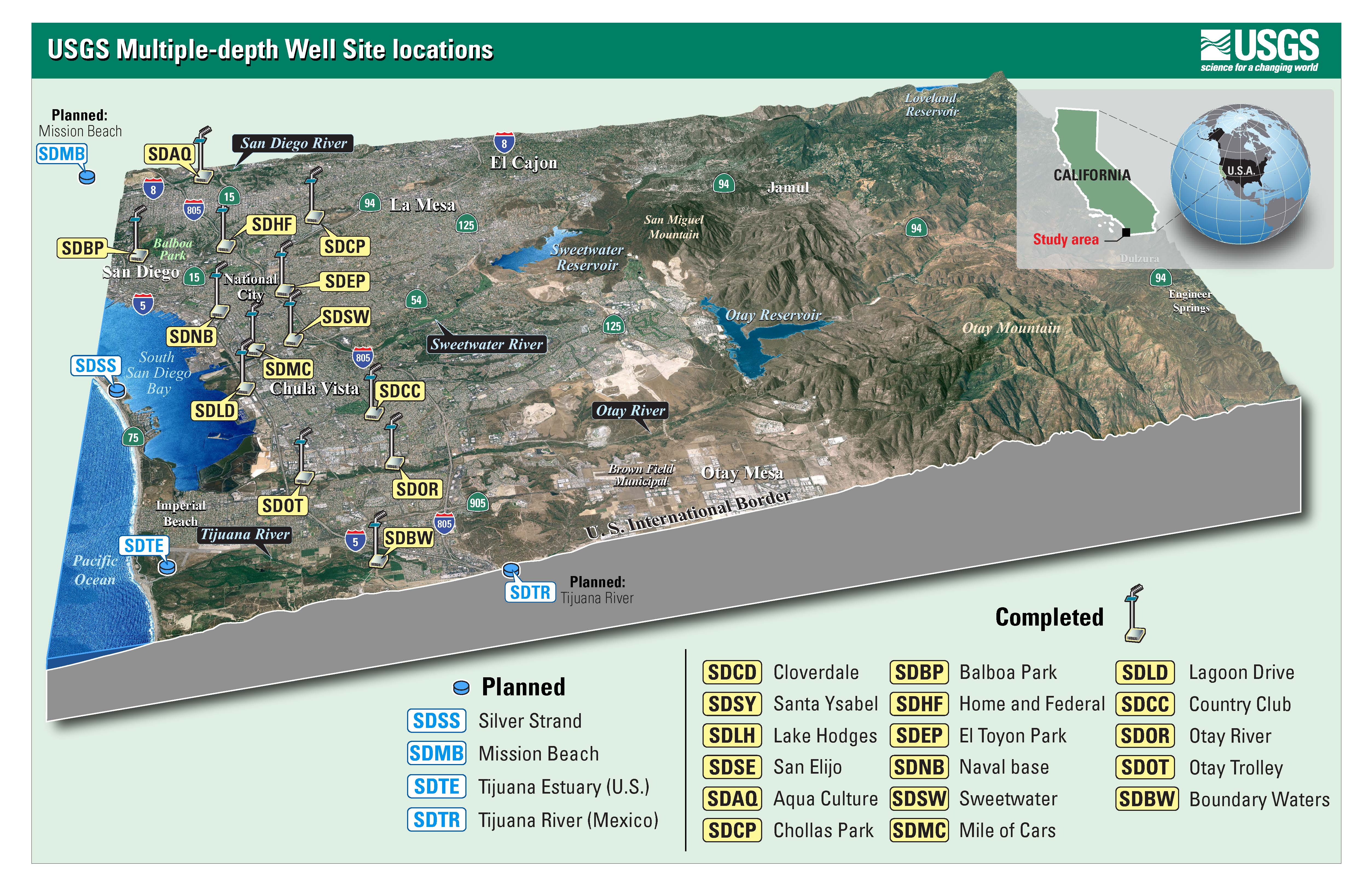
Map of completed and planned multiple-depth well sites in the San Diego Hydrogeology project. Click on image to download map in PDF format.
Part or all of this page is linked to a Portable Document Format (PDF); the latest version of Adobe Reader or similar software is required to view it. Download the latest version of Adobe Reader, free of charge.
Questions about San Diego Hydrogeology? Please contact Wes Danskin (email: wdanskin@usgs.gov or send a letter). 619.225.6132