California's Central Valley

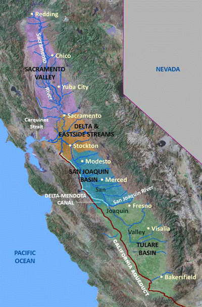
Map of the Central Valley's four major regions.
Regional Characteristics
The Central Valley, also known as the Great Valley of California, covers about 20,000 square miles and is one of the more notable structural depressions in the world. Occupying a central position in California, it is bounded by the Cascade Range to the north, the Sierra Nevada to the east, the Tehachapi Mountains to the south, and the Coast Ranges and San Francisco Bay to the west. The Valley is a vast agricultural region drained by the Sacramento and San Joaquin Rivers. The Valley averages about 50 miles in width and extends about 400 mi northwest from the Tehachapi Mountains to Redding. Generally, most of the valley lies close to sea level and the land surface has very low relief, but is higher along the valley margins.
The Central Valley can be divided into two large parts: the northern one-third is known as the Sacramento Valley and the southern two-thirds is known as the San Joaquin Valley. The San Joaquin Valley can be split further into the San Joaquin Basin and the Tulare Basin. The San Joaquin and Sacramento Valleys meet in the Delta area where the combined discharge of the Sacramento and San Joaquin Rivers flows through the Central Valley's one natural outlet, the Carquinez Strait, on its way to San Francisco Bay and the Pacific Ocean. Just east of the Delta, several streams issue from the Sierra Nevada into the valley and flow to the Delta in an area referred to as the Eastside Streams.
