Sustainable Groundwater
Water-Quality Degradation
The California Department of Water Resources (DWR) has drafted Best Management Practices (BMPs) for monitoring groundwater quality. This USGS site includes information, tools, and data relevant to DWR's BMPs, and additional resources, to help water managers address key components of the required Groundwater Sustainability Plans (GSPs), including monitoring. Resources are listed on the Resources page of this site, and relevant resources are also listed in bullet points at the conclusion of each section.
The processes affecting water quality vary widely and depend on a complex suite of factors, including geology and local aquifer conditions, human activities related to land use, and well construction and operation. Understanding changes in water quality as a result of changes in land and water use involves systematic monitoring of constituents of concern, coupled with an understanding of the dynamics of a groundwater-flow system.
Groundwater Quality Monitoring
One of the potential consequences of groundwater overdraft is water-quality degradation. The USGS has characterized many linkages between water use and water quality and found that the processes affecting water quality vary widely and depend on a complex suite of factors. These factors can include natural geology and local aquifer conditions, human activities related to land use, and well construction and operation. Determining changes in groundwater quality over time involves systematic monitoring of constituents of concern, coupled with an understanding of the dynamics of a groundwater-flow system.
Groundwater quality can be assessed using both existing wells installed for water supply and wells installed specifically for monitoring. Groundwater monitoring-well networks and related data are developed based on the characteristics and needs of each groundwater basin.
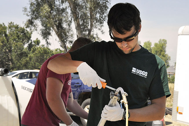
A USGS hydrologist prepares equipment during groundwater sampling in Jurupa Valley, Calif. Photo: USGS.
Water-quality data for principal aquifers may be available based on information from existing technical studies or regulatory programs. The USGS has a wide body information, data, and tools to support water-quality assessments statewide. Combining USGS data with other quality-assured data can assist water managers and GSAs with basin-wide assessments and water quality mapping. Links to data are indicted at the conclusion of each section, for the example studies described below.
Available USGS California Water Quality Data
Groundwater Ambient Monitoring and Assessment Program (GAMA)
Starting in 2000, the Groundwater Ambient Monitoring and Assessment Program began a comprehensive assessment of statewide groundwater used for public supply. The initial sampling and analysis of that data is complete and publications and data for all of the principal aquifers in California are available online. GAMA has improved statewide groundwater monitoring and increased the availability of groundwater information and data for the public and resource managers. The program is an interagency collaboration with the State and Regional Water Boards, Department of Water Resources, Department of Pesticide Regulations, Lawrence Livermore National Laboratory, and U.S. Geological Survey, in cooperation with local water agencies and well owners.
GAMA assesses current groundwater quality and characterizes the natural and human factors that affect groundwater quality across basins. While GAMA has completed the sampling and characterization of public-supply zone aquifers, the program has expanded and is currently in the process of sampling and characterizing shallow-zone aquifers. Data analysis to better understand water-quality trends throughout the state continues. This information will enable the public and decision makers to better assess statewide groundwater quality and quantity.
- Data and interpretive reports prepared by USGS are posted on the USGS GAMA Program website
- Water-quality data are available through the State Water Board's GeoTracker GAMA database
Sampled Water Quality Constituents
| Constituents | Why Constituents are of Interest |
|---|---|
| Specific conductance | The ability of a water sample to transmit an electrical current, which is related to the salinity of the water. |
| Alkalinity, pH, and dissolved oxygen | The cation and anion activity, and oxygen concentration in water. These properties affect the mobility of dissolved chemical compounds. |
| Temperature | Temperature can influence the concentration of dissolved gases (e.g. oxygen, nitrogen, carbon dioxide) in water. |
| Major and minor ions | Naturally occurring elements that influence water quality. |
| Nutrients | Elevated concentrations of compounds (e.g. nitrogen, phosphorous) can degrade water quality. |
| Dissolved organic carbon (DOC) | DOC compounds impact water chemistry (O2 concentrations and pH), biological productivity and trihalomethane formation. |
| Trace elements | Naturally occurring elements, in low concentrations, define water characteristics and affect water quality. |
| Chromium (total and VI) | Naturally occurring and industrial element that can degrade water quality. |
| Isotopes, radioactivity | Naturally occurring atoms and radioactivity used to track water movement and may degrade water quality at high concentrations. |
| Tritium (3H) | Isotope of hydrogen used to identify water masses less than 50 years of age. |
| Noble Gases | Dissolved gases used to trace ground-water movement, for chronology, and to indicate climate change. |
| Stable isotopes (δ18O, δD) | Naturally occurring isotopes of oxygen and hydrogen used to track water through the hydrologic cycle. |
| Radon (Rn) | A naturally occurring radioactive gas which, at high levels, can cause health problems such as lung cancer. |
| Radium (Ra) | A naturally occurring radioactive element that is present in varying amounts in the Earth's crust. |
| Volatile organic compounds (VOCs) | Anthropogenic compounds including solvents, gasoline additives, and organic synthesis products that can degrade water quality. |
| Methyl tert-Butyl Ether (MTBE) | A compound added to gasoline to improve air quality. At high concentrations it can degrade water quality. |
| Perchlorate (ClO4-) | Anthropogenic compound recently identified as a potential water-quality concern. |
| N-nitrosodimethylamine (NDMA) | A byproduct of water treatment from the reaction of dimethylamine and chloramines which can degrade water quality. |
| Pesticides | Used to control weeds, insects, and other pests and can degrade water quality. |
| Wastewater indicators | Commonly used compounds (e.g. caffeine, fragrances, insect repellents) that can enter ground water from the discharge of treated wastewater. |
| Pharmaceutical products | Medicinal compounds that can enter ground water from discharge of treated wastewater, recycled water, or reclaimed water. |
| Coliphage and Escherichia coli (E. coli) | Used as microbial indicators of fecal pollution. |
This is a list of a few of the constituents for which the GAMA program samples. Groundwater samples are analyzed for a large suite of chemical constituents, including nutrients, human-made organic constituents, naturally occurring trace elements, and tracers used to help identify the source and age of the sampled groundwater.
National Water-Quality Assessment (NAWQA): California Assessments
The National Water-Quality Assessment (NAWQA) Program assess status and trends in the quality of freshwater streams and groundwater aquifers to provide a sound understanding of the natural and human factors that affect the quality of these resources. NAWQA assessments in California include the Sacramento River Basin, the San Joaquin-Tulare Basins, and the Santa Ana Basin. The program evaluates factors causing change in these heavily used groundwater basins, and assesses vulnerability with respect to specific constituents.
Written primarily for public and private decision-makers, NAWQA summary reports discuss water quality in terms of status, trends, natural and human factors, and implications for management and decision making. The consistent, multi-scale approach used in all assessments helps to determine if certain types of water-quality issues are isolated or pervasive, and allows direct comparisons of how human activities, land use, and natural factors affect water quality and ecological health in California’s diverse geographic and environmental settings. Water-quality conditions are compared to national water-quality statistics as well as considered against national water-quality standards and guidelines related to drinking water, protection of aquatic life, and nutrient enrichment.
Trends Analysis
NAQWA and GAMA are monitoring trends in a large number of California wells using historical and continued periodic sampling data. This effort seeks to find relations between observed trends and a wide array of explanatory factors, complementing previous status assessments and long-term monitoring efforts.
Results from ongoing trends analysis are available on the USGS GAMA Program website and NAWQA Trends Site. Examples of existing trends analysis in California are detailed in the following publications:
- Assessment of regional change in nitrate concentrations in groundwater in the Central Valley, California, USA, 1950s–2000s
- Trends in concentrations of nitrate and total dissolved solids in public supply wells of the Bunker Hill, Lytle, Rialto, and Colton groundwater subbasins, San Bernardino County, California: Influence of legacy land use
- Relations of hydrogeologic factors, groundwater reduction-oxidation conditions, and temporal and spatial distributions of nitrate, Central-Eastside San Joaquin Valley, California, USA
Regional Monitoring of Oil and Gas Development Impacts on California Groundwater
California Senate Bill 4 (2013) mandates monitoring of the effects of Well Stimulation Treatment on groundwater quality. The State Water Board and the USGS are cooperating on a Regional Groundwater Monitoring Program to determine where and to what degree groundwater quality is potentially at risk from oil and gas production activities. The USGS work towards this effort includes salinity mapping, oilfield-water characterization, and regional groundwater monitoring and analysis in priority areas. Implementation of the regional monitoring began in 2016. Preliminary findings are available online.
Water Quality Monitoring in Los Angeles
The USGS and the Water Replenishment District of Southern California (WRD) have installed and maintained an extensive network of over 400 groundwater monitoring wells at approximately 60 sites to monitor changes in groundwater-levels and water quality in the Central and West Coast Basins of Los Angeles. The data are used to manage the groundwater basins and address water quality issues, including seawater intrusion.
Long-Term Monitoring in Mojave River and Morongo Groundwater Basins
Since 1992, the USGS in cooperation with the Mojave Water Agency (MWA), has constructed a series of regional water-table maps characterizing groundwater conditions in the Mojave River and Morongo groundwater basins. These maps are based on data from the statewide GAMA program with ongoing MWA/USGS groundwater-quality monitoring.
Groundwater Recharge and Water Quality
Groundwater recharge by natural or artificial means can cause changes in groundwater quality. These changes will depend on many factors, including the chemistry of the source water, land use, soil and sediment characteristics, the groundwater flow dynamics. The potential for water-quality changes should be evaluated before, during, and after implementation of an artificial recharge program.
From the late 1940s through 1994, water levels in the Warren subbasin declined as much as 300 ft. due to groundwater extraction. In response, the Hi-Desert Water District (HDWD) instituted an artificial recharge program to replenish the groundwater basin using imported California State Water Project (SWP) water. The program resulted in water-level recovery of about 250 ft. between 1995 and 2003. However, nitrate concentrations in some wells also increased to levels above the USEPA maximum contaminant level. The USGS concluded that septage from septic tanks was the primary source of nitrate to the groundwater system.
Learn more about water quality considerations during groundwater recharge:
- Evaluation of the Source and Transport of High Nitrate Concentrations in Ground Water, Warren Subbasin, California
- Selected Techniques for Monitoring Water Movement Through Unsaturated Alluvium During Managed Aquifer Recharge
- The Effects of Artificial Recharge on Groundwater Levels and Water Quality in the West Hydrogeologic Unit of the Warren Subbasin, San Bernardino County, California
- Movement of Water Infiltrated from a Recharge Basin to Wells (Stockton, California)
Basin-Scale Groundwater Quality Assessments
Compiling and analyzing existing groundwater quality data and collecting new data from selected wells to fill gaps in information provides groundwater chemistry data that can be used to understand groundwater flow patterns and how they change in response to groundwater development. The following are examples of USGS studies in which geochemical and geohydrologic data have been used in combination with modeling to characterize basin-scale groundwater quality and availability:
- Hydrogeology, hydrologic effects of development, and simulation of groundwater flow in the Borrego Valley, San Diego County, California
- Initial characterization of the groundwater system near the Lower Colorado Water Supply Project, Imperial Valley, California
- Hydrologic and geochemical characterization of the Santa Rosa Plain watershed, Sonoma County, California
Assessing Groundwater Quality: A 3-Dimensional Challenge
The physical properties of an aquifer play a large part in determining how water quality changes in response to changes in the groundwater flow system. Because groundwater moves slowly and geochemical processes can occur at different rates, changes in groundwater quality may require years to decades to become evident. Detailed vertical resolution of water quality in relation to aquifer characteristics can provide insight into the three-dimensional processes and factors that may cause changes in water quality through time.
Borehole geophysical logging can be used to monitor changes in water quality at multiple well depths. Models can simulate depth profiles of water quality and borehole flow in supply wells to provide information on where water and contaminants enter well screens and how that might be affected by changing groundwater conditions. Examples of tools and techniques for analyzing vertical profiles of water quality through aquifers are provided below:
- Electromagnetic-Induction Logging to Monitor Changing Chloride Concentrations
- AnalyzeHOLE—An Integrated Wellbore Flow Analysis Tool
- Source, Distribution, and Management of Arsenic in Water from Wells, Eastern San Joaquin Ground-Water Subbasin, California
- Temporal changes in the vertical distribution of flow and chloride in deep wells
- USGS Research Drilling Program: Drilling Methods
Search All Resources >>
Have a SGMA science question or collaboration idea?
The USGS California Water Science Center works with Local, State and other Federal agencies to conduct studies that will help give water managers the knowledge they need to effectively allocate water resources under increasing demands.
USGS Data & Conditions
- Real-Time Data
- Streamflow
- WaterWatch
- USGS Data Mapper
- Groundwater
- Data | Watch | Regional
- Surface Water
- Data | Watch
- Water-Quality
- Data | Watch | Mapper
- USGS WaterNow
- Current-conditions for water data directly to your mobile phone or email.