San Diego Hydrogeology
Watershed Boundary Dataset
This data set is a complete digital hydrologic unit boundary layer to the Subwatershed (12-digit) 6th level for the coterminous United States. This data set consists of geo-referenced digital data and associated attributes created in accordance with the "FGDC Proposal, Version 1.0 - Federal Standards For Delineation of Hydrologic Unit Boundaries 3/01/02"(http://www.ftw.nrcs.usda.gov/huc_data.html). Polygons are attributed with hydrologic unit codes for 4th level sub-basins, 5th level watersheds, 6th level subwatersheds, name, size, downstream hydrologic unit, type of watershed, non-contributing areas and flow modification. Arcs are attributed with the highest hydrologic unit code for each watershed, linesource and a metadata reference file.
The Watershed and Subwatershed hydrologic unit boundaries provide a uniquely identified and uniform method of subdividing large drainage areas. The smaller sized 6th level sub-watersheds (up to 40,000 acres) are useful for numerous application programs supported by a variety of local, State, and Federal Agencies. This data set is intended to be used as a tool for water-resource management and planning activities, particularly for site-specific and localized studies requiring a level of detail provided by large-scale map information. The dataset will be appended to a larger seamless nationally consistant geospatial database as other states complete their portion of the watershed boundary dataset.
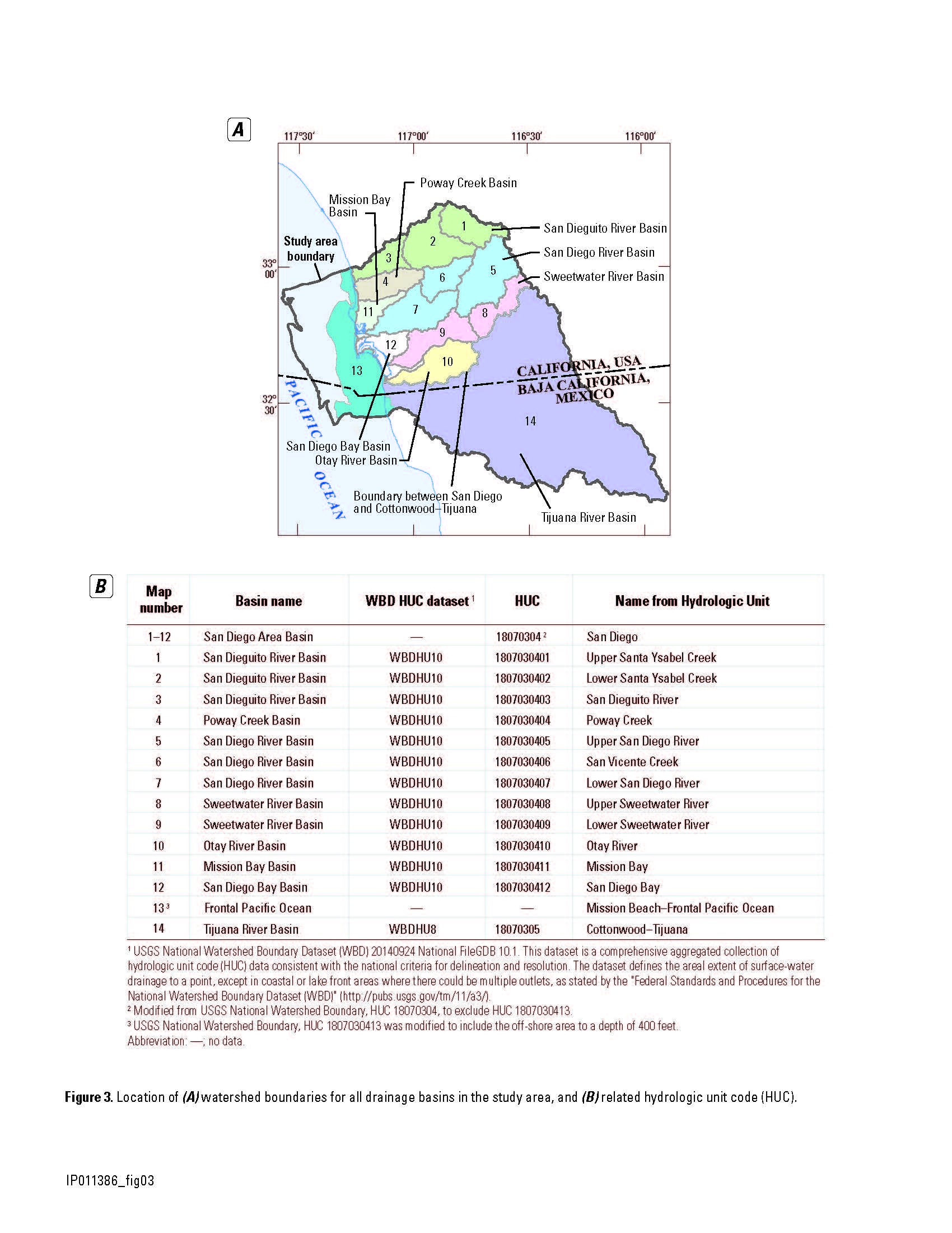
- Watershed basins in the study area (PDF)
- Download shapefile - WBDHU8.zip, WBDHU10.zip, WBDHU12.zip
- Metadata - 19139 XML
- WBD data download viewer (National Map website)
Note: Users are recommended to obtain the latest Watershed Boundary Dataset (WBD) from the National Hydrography website (https://www.usgs.gov/national-hydrography/watershed-boundary-dataset).
Project Chief: Wes Danskin
Phone: 619-225-6132
Email: wdanskin@usgs.gov
Welcome to the United States Geological Survey (USGS) San Diego Hydrogeology (SDH) project website, which provides geologic and hydrologic information for the transboundary San Diego–Tijuana area, USA and Mexico. This website provides background information about the project; a variety of news items; a large amount of data, in particular for USGS multiple-depth, monitoring-well sites; geologic and hydrologic models; and additional resources including photos, illustrations, and references.
Last updated: July 2023.
Some additional data may be available from the USGS database National Water Information System (NWIS).
Questions about San Diego Hydrogeology? Please contact Wes Danskin (email: wdanskin@usgs.gov or send a letter). 619.225.6132