San Bernardino Optimal Basin Management
USGS Data Map
Data Map Options
Please wait until a new map layer is displayed before turning on/off the next layer.
Click + to turn layer on.
Click - to turn layer off.
Click linked text for additional information.
Click on map icons for additional information about that site.
Note: Drawing time may vary with connection speed and browser and charts must be displayed from the USGS installed wells page.
Multiple-depth well sites
Groundwater sites
NWIS groundwater sites (well)
Surface-water
NWIS surface-water sites (estuary, lakes, streams, & spring)
Project study area
Project developed data
Project study area subbasins
Project developed data
Geology from CA Geological Survey
These datasets will be replaced soon.
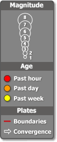
Recent Earthquakes (Turning this layer on may disable map functions.)
USGS earthquakes
Questions about Optimal Basin Management? Please contact Wes Danskin (email: wdanskin@usgs.gov or send a letter). 619.225.6132