Regional Hydrology
Regional Hydrology Projects
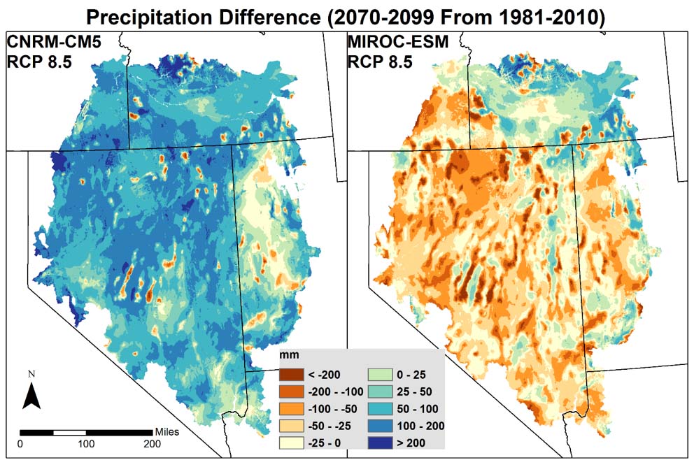
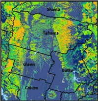
Basin Characterization Model of the Great Basin: A Dataset of Historical and Future Hydrologic Response to Climate Change
Climate change in the Great Basin threatens snowpack, surface water resources, vegetation dynamics, and landscapes, all of which work together to provide ecosystem services, particularly a good supply of high quality water.

Soil Moisture Datasets at Five Sites in the Central Sierra Nevada and Northern Coastal Ranges, California
In situ soil moisture datasets are important inputs used to calibrate and validate watershed, regional, or statewide modeled and satellite-based soil moisture estimates. These soil moisture datasets include hourly time series of soil temperature, volumetric water content, water potential, and total soil water content for three snow-dominated watershed sites in the central Sierra Nevada Range, and two coastal fog-dominated watersheds sites in the northern Coastal Range.
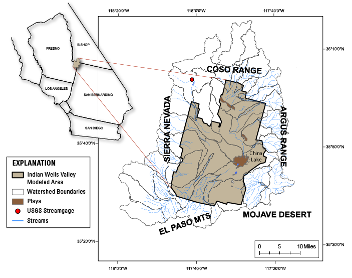
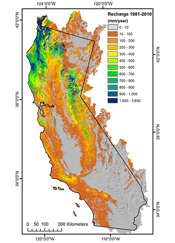
Using the Basin Characterization Model to Estimate Natural Recharge in Indian Wells Valley, California
Understanding the rate and amounts of natural groundwater recharge in the Indian Wells Valley is important to developing resource-management plans for the groundwater basin and the communities that depend on it.
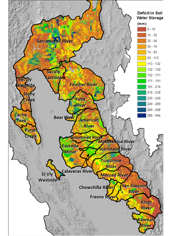
Soil Water Deficit and Drought
Deficits in soil moisture have the potential to reduce runoff as a result of rainfall or snowmelt replenishing the soil to field capacity prior to runoff.
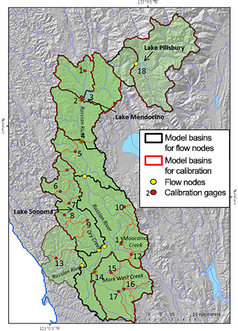
Coping with Drought in the Russian River Watershed
Two multi-purpose reservoirs in the Russian River region provide storage for warm-season uses, and there is little to no snow pack to extend the runoff season.
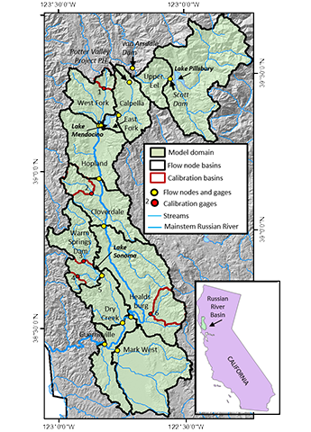
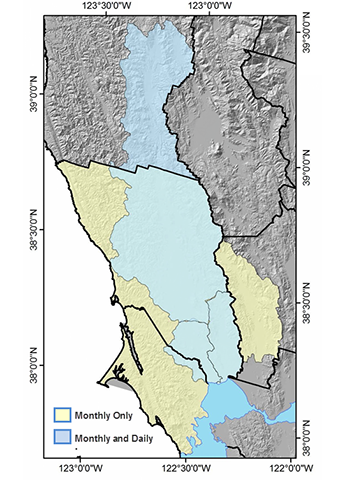
Russian River Unimpaired Daily Streamflow
Sustainable management of water resources requires estimates of unimpaired streamflow to assess impacts related to changes in land use, population, climate, and policy.
Climate Ready Vulnerability Assessment
To create a framework for adapting to climate change, decision makers need to understand specific threats to our water supply, land use suitability, hazard risks, ecosystems and quality of life.
Characterization of Hydrologic Conditions for Species Distributions Along Environmental Gradients
Physiological strategies and functional traits provide a key starting point to understand how plant distributions are shaped along gradients of climate and soils.
Refinement of the Basin Characterization Model to Improve California Department of Water Resources Forecasting for Water Supply
Refine the Basin Characterization Model (BCM) to improve estimates of spring snowmelt and runoff, and develop products useful for forecasting water-supply needs under extreme conditions, such as drought.

Climate and Natural Resources Analysis and Planning for California's Northern Coast
The USGS will work with Pepperwood Preserve to provide analysis and planning support for climate-change adaptation, forest ecology and watershed hydrology, and groundwater analyses and planning.
Increasing Soil Organic Carbon to Mitigate Greenhouse Gases and Increase Climate Resiliency for California
Enhancing soil carbon in working lands at large spatial scales has the potential to measurably reduce greenhouse gas levels in the atmosphere, increase the sustainability of working landscapes and ensure the provision of other ecosystem services, including water, food and wildlife habitat.