California's Central Valley
Central Valley Groundwater Availability
The Central Valley study is one of 30 regional aquifer studies the USGS is conducting to assess the Nation's groundwater availability. Intense competition for groundwater resources in California was an important factor in choosing the Central Valley as one of the first studies undertaken and completed.
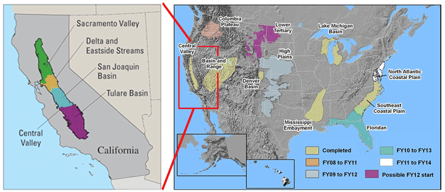
Map of USGS Groundwater Resources Program regional scale groundwater study areas. Explanation indicates the fiscal years during which the studies are planned to occur.
In order to complete the study, the USGS developed an extensive, detailed three-dimensional (3D) computer model of the hydrologic system of the Central Valley. The Central Valley Hydrologic Model (CVHM) simultaneously accounts for changing water supply and demand across the landscape, and simulates surface water and groundwater flow across the entire Central Valley. In order to simulate this supply and demand, the CVHM has a large number of supporting datasets.
The CVHM, a new hydrologic modeling tool, can be used by water managers to understand how water moves through the aquifer system, predict water-supply scenarios, and address issues related to water competition in California and the Central Valley including:
- Conjunctive water use (interdependent use of surface water and groundwater)
- Conservation of agricultural land
- Land-use change, including environmental concerns and urbanization, and its effects on water resources
- Effects of climate change