Mojave Groundwater Resources
Mojave Region Hydrographs
A hydrograph shows a period of record for a well. Symbols indicate actual data values from the USGS National Water Information System (NWIS). Multiple colors indicate two or more wells used for historical tracking of water levels.
Mojave Region Maps
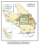
General Location
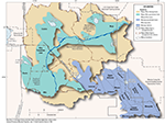
Detailed Location Map
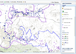
Interactive Data Map
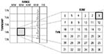
Well-Numbering System

To view PDF documents, you must have Adobe Reader installed on your computer.