


Hydrologic Modeling Software
The USGS has been a leader in the development of hydrologic and geochemical simulation models since the 1960's. USGS models are widely used to predict responses of hydrologic systems to changing stresses, such as increases in precipitation or ground-water pumping rates, as well as to predict the fate and movement of solutes and contaminants in water.
For more USGS modeling software see: USGS Water Resources Software.
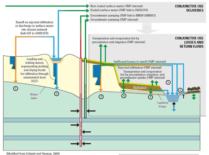
MODFLOW-OWHM: One Water Hydrologic Flow Model
The One-Water Hydrologic Flow Model (MF-OWHM) is a MODFLOW-based integrated hydrologic flow model (IHM). MF-OWHM is designed for the analysis of a broad range of conjunctive-use issues. MF-OWHM allows the simulation, analysis, and management of human and natural water movement within a physically-based supply-and-demand framework.
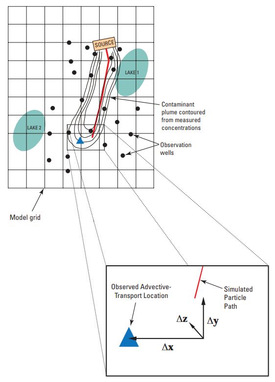
MODPATH Observation Process
MODPATH Observation Process (MODPATH-OBS) is a program developed to calculate simulated equivalents to transport observations derived from simulated particle tracking with or without field measurements for a variety of common field situations or hydrologic settings. The method can be used for transient and steady-state flow simulations.
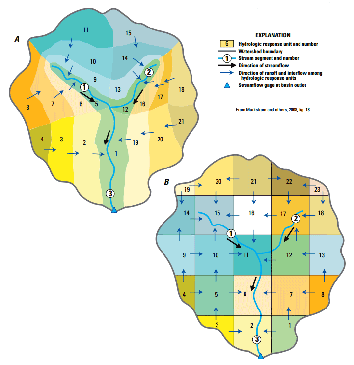
Cascade Routing Tool
The U.S. Geological Survey Cascade Routing Tool (CRT) is a computer application for watershed models that include the coupled Groundwater and Surface-water FLOW model GSFLOW and the Precipitation-Runoff Modeling System (PRMS). CRT generates output to define cascading surface and shallow subsurface flow paths for grid-based model domains.
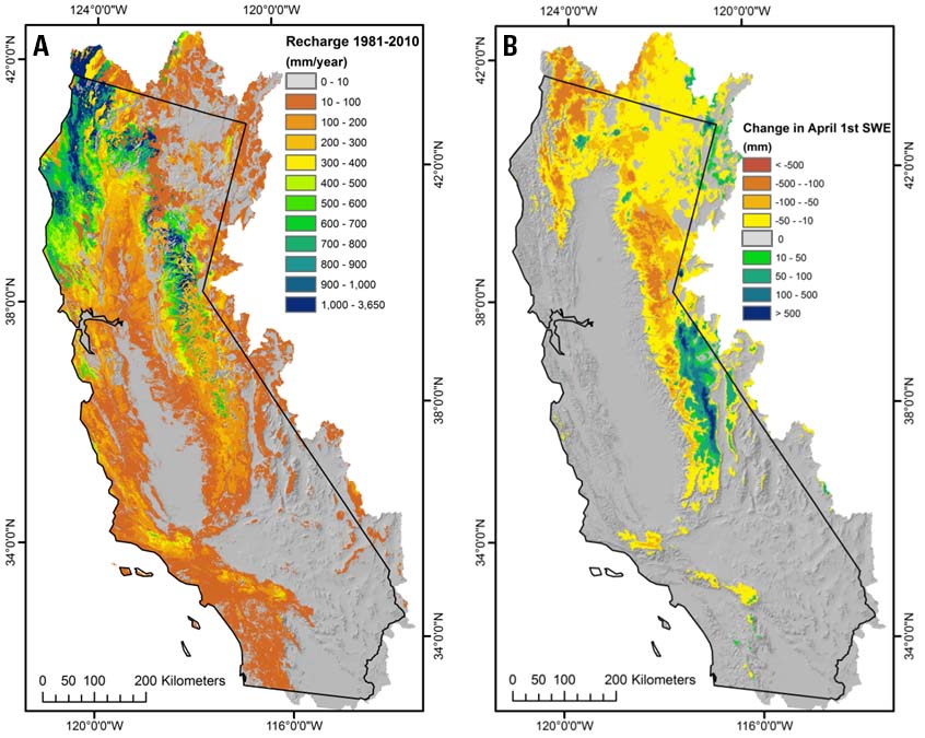
Basin Characterization Model
The Basin Characterization Model (BCM) models the interactions of climate (rainfall and temperature) with empirically measured landscape attributes including topography, soils, and underlying geology. It is a grid-based model that calculates the water balance (the amount of water in each of the fractions of the total water budget, including runoff, recharge, and evapo-transpiration) for each 18-acre cell (270m resolution) in a given watershed in set time steps for the entire area. The California BCM uses a minimum time step of monthly results at the scale of a 270m grid, allowing the generation of scenarios at annual, seasonal, or monthly time steps.