
By Steven K. Predmore, Kathryn M. Koczot, and Katherine S. Paybins
U.S. Geological Survey Open-File Report 96-629
The Regional Aquifer-System Analysis (RASA) program of the U.S. Geological Survey began in 1978. The purpose of this program was to define the regional hydrology and geology of the Nation's important aquifer systems and to establish a framework of background information on the geology, hydrology, and geochemistry of these aquifer systems (Martin, 1986). This information is needed to develop an improved understanding of ground-water-flow systems and to support better management of ground-water resources. Twenty-eight regional aquifer systems have been identified and studied nationwide as part of this program. Unlike some aquifer systems, the 75,000 square mile regional aquifer system in southern California is not integrated; it consists of 89 separate alluvial basins. For the purpose of the Regional Aquifer-System Analysis study, these basins were grouped into coastal and desert basins. A representative basin was selected from each group for intensive study; the Santa Clara-Calleguas Basin was selected for the coastal basin study and the Mojave River Basin was selected for the desert basin study (fig. 1)
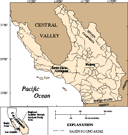
The Santa Clara-Calleguas Basin is about 60 miles northwest of Los Angeles. This basin was selected for intensive study because it contains a large, complex aquifer system that is affected by many of the hydrologic problems and issues that affect other coastal basins throughout southern California. These problems and issues include ground-water depletion, ground-water contamination, seawater intrusion, quantity and distribution of recharge, interaquifer flow, and consumptive use of ground water and surface water.
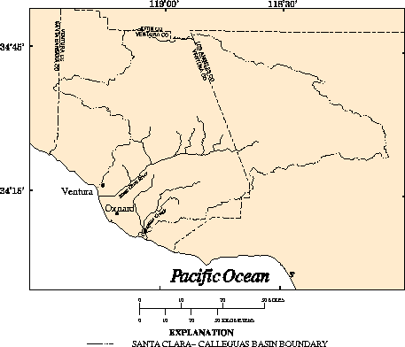
The Santa Clara-Calleguas Basin is 2,010 square miles. Although most of the area is characterized by rugged topography, about 310 square miles consists of relatively flat valley floor and coastal plain areas underlain by water-bearing deposits that are more than 1,000 feet thick in places. The area is drained by the Santa Clara River and Calleguas Creek, both of which discharge to the Pacific Ocean. (fig. 2)
The purpose of this report is to document digital spatial data compiled
for the Santa Clara- Calleguas Basin between October 1989 and December
1995. A geographic information system (GIS) was used to assemble, store,
analyze, and display the geographically referenced data collected during
this study. This GIS data base contains 36 spatial data layers and 4 data
tables. These data were collected as part of the Southern California
Regional Aquifer-System Analysis study by the U.S. Geological Survey and
as part of cooperative studies funded by the United Water Conservation
District, Fox Canyon Ground Water Management Agency, Metropolitan Water
District, Calleguas Municipal Water District, city of Channel Islands
Beach, and U.S. Navy, Pacific Missile Test Center.