
California Water Science Center
Skip navigation to main content.

|
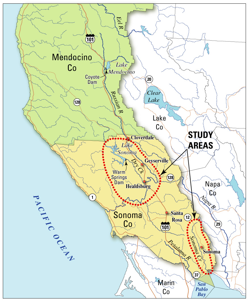 Sonoma County Project Area Location Map Water Resources Availability and Management in Sonoma County, CA Problem: Sonoma County is in the northern part of the greater San Francisco Bay region, an area of Northern California that has experienced rapid population growth and accelerated urbanization in response to economic expansion over the past few decades.The large increase in population and concomitant changes in land use within Sonoma County require reassessment of the water resources and how best to manage them for optimal utilization over the next few decades. The Sonoma County Water Agency (SCWA) is responsible for supplying water to about 570,000 people throughout Sonoma County and neighboring Marin County. Most basins in Sonoma County currently rely on a combination of Russian River water and native ground water to meet demand. SCWA needs to develop new strategies to efficiently deliver water that maximizes the resource potential of Russian River water linked with ground-water resources in the individual basins. Optimization of the conjunctive use of surface water and ground water can benefit local municipal water purveyors, agricultural water users, and residential water users by maximizing the availability of water in each geographic area of the county. In order to effectively undertake and succeed in developing and implementing a plan for optimizing the utilization of the county's water resources, an up to date assessment of hydrologic conditions is needed and a more detailed investigation of the hydrologic system needs to be completed that quantifies the interconnection of surface water and ground water. For a ground-water system as large and complex as exists in Sonoma County a set of numerical models that simulate the hydrologic systems in the different basins will ultimately be required. Ground-water conditions have changed significantly since the last countywide studies were conducted 20–25 years ago by the California Department of Water Resources (1975, 1982a, 1982b, 1982c, and 1983). In some areas the quantity of ground water available to meet the demand may be diminished by degradation of quality from sea-water intrusion, high nitrate concentrations, or mixing with waters high in mineral content. The quantity of water available from the Russian River system may also be reduced because of changes in water rights related to diversions from the Eel River Basin. This is significant because the Russian River is the main source of recharge to the ground-water system in the Russian River Basin 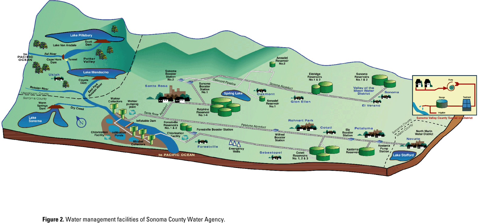 SCWA Water Management Facilities To address water-availability, quality, and management issues countywide, a long-term cooperative program has been established between the SCWA and the U.S. Geological Survey (USGS). The ground-water basins of interest are: Sonoma Valley, Alexander Valley, Santa Rosa Plain, and Petaluma Valley. Under this cooperative program, each ground-water basin will be studied and the hydrologic information will be added to a geographic-information system (GIS) being developed by SCWA and Sonoma County. Ground-water flow models will be developed for the Sonoma Valley, Santa Rosa Plain, and Petaluma Valley; these models will eventually be unified into an optimization model for water supply. The geohydrology and water chemistry will only be described for the Alexander Valley.
|
![]() U.S. Department of the Interior | U.S. Geological Survey
U.S. Department of the Interior | U.S. Geological Survey
URL: http://ca.water.usgs.gov/user_projects/sonoma/index.html
For Page Information: Send Us a Message
Page Last Modified: Tuesday, 14-Jun-2011 14:29:41 EDT