San Diego Hydrogeology
San Diego Hydrogeology Study Area Dataset
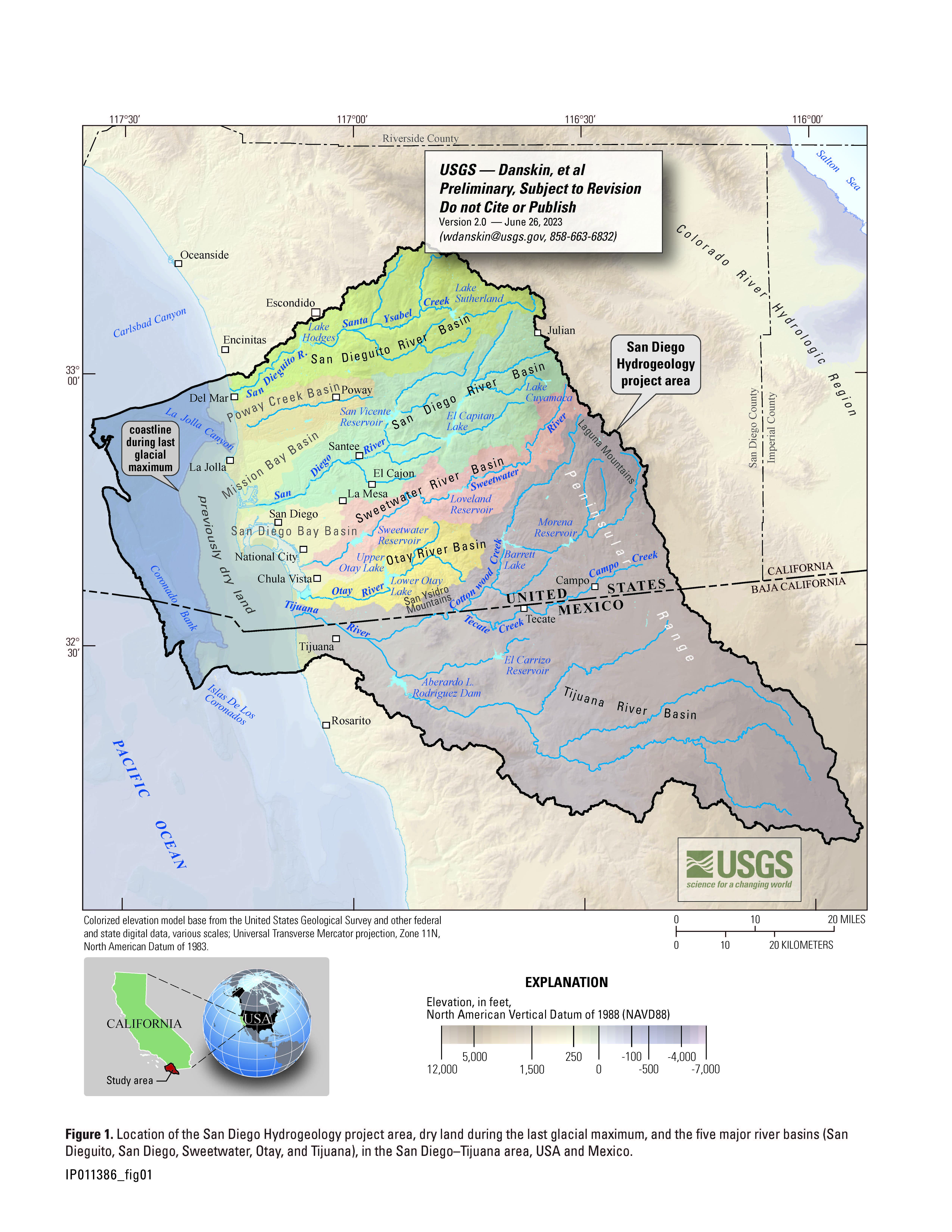 This regional assessment of the greater San Diego—Tijuana area was designed to include five river basins (San Dieguito, San Diego, Sweetwater, Otay, and Tijuana), to gather detailed information about the interaction between surface water and groundwater in each river basin, to identify sources of groundwater recharge, and to gain a better understanding of the hydrogeology of the areally extensive San Diego Formation. The 5 major river basins and 3 smaller drainage basins (Poway Creek, Mission Bay, and San Diego Bay) are referred to collectively as drainage basins in this report and are defined by hydrologic unit codes (HUCs).
- Study area (PDF)
- Download shapefile (coming soon)
Project Chief: Wes Danskin
Phone: 619-225-6132
Email: wdanskin@usgs.gov
Welcome to the United States Geological Survey (USGS) San Diego Hydrogeology (SDH) project website, which provides geologic and hydrologic information for the transboundary San Diego–Tijuana area, USA and Mexico. This website provides background information about the project; a variety of news items; a large amount of data, in particular for USGS multiple-depth, monitoring-well sites; geologic and hydrologic models; and additional resources including photos, illustrations, and references.
Last updated: July 2023.
Some additional data may be available from the USGS database National Water Information System (NWIS).
Questions about San Diego Hydrogeology? Please contact Wes Danskin (email: wdanskin@usgs.gov or send a letter). 619.225.6132