Cuyama Valley
Using Hydrologic Models to Study Water Availability in Cuyama Valley
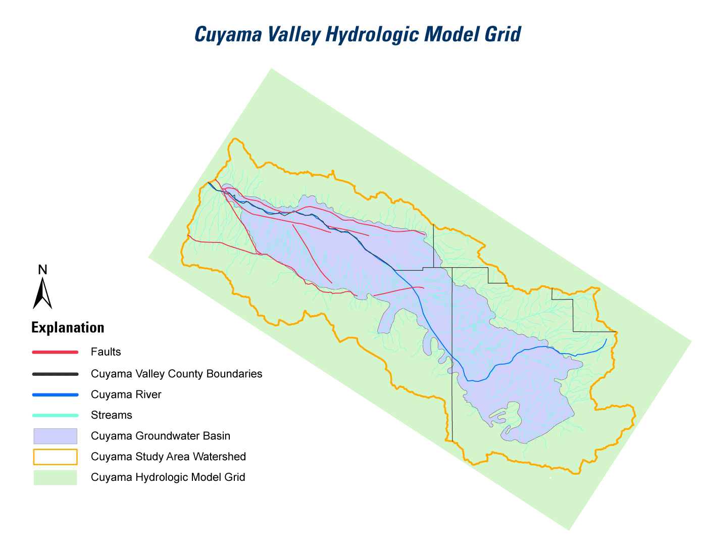
Data and analyses from the in-depth study of the geologic framework of the aquifer system will be used to update and improve a three-dimensional geologic and hydrologic framework of the basin, and associated hydrologic model. The hydrologic model will simulate a number of water-supply scenarios and assess possible changes in groundwater supply. The model and additional findings from the study will be released in the two subsequent reports later in the year and in 2014.
Cooperators
Prepared in cooperation with Santa Barbara County Water Agency
![]()
Publications
- Hanson, R.T., Flint, L.E., Faunt, C.C., Gibbs, D.R., and Schmid, W., 2014,
- Hydrologic models and analysis of water availability in Cuyama Valley, California: U.S Geological Survey Scientific Investigations Report 2014-5150, 150 p., http://dx.doi.org/10.3133/sir20145150.
- Hanson, Randall T., and Sweetkind, Donald, 2014,
- Cuyama Valley, California hydrologic study—An assessment of water availability: U.S. Geological Survey Fact Sheet 2014-3075, 4 p., http://dx.doi.org/10.3133/fs20143075.
Contacts
Claudia C. Faunt, Ph.D., P.E.
Program Chief, Groundwater Availability and Use Assessments
U.S. Geological Survey
California Water Science Center
4165 Spruance Road, Suite 200
San Diego, CA 92101
619.225.6100
ccfaunt@usgs.gov
Matthew Scrudato
Senior Hydrologist
Santa Barbara County Public Works Department
620 West Foster Road
Santa Maria, CA 93455
mscruda@cosbpw.net