California's Central Valley
Groundwater Modeling
A groundwater flow model is a mathematical representation of groundwater flow through an aquifer, which is composed of saturated sediment and rock. In order to solve the equations that constitute the flow model, it is necessary to make simplifying assumptions about the aquifer and the physical processes governing groundwater flow. The most important of these assumptions are embodied in the conceptual model of the aquifer.
Although groundwater flow models can't be as detailed or as complex as the real system, models are useful in at least four ways:
- models integrate and assure consistency among aquifer properties, recharge, discharge, and groundwater levels
- models can be used to estimate flows and aquifer characteristics for which direct measurements are not available
- models can be used to simulate response of the aquifer under hypothetical conditions
- models can identify sensitive areas where additional hydrologic information could improve understanding
Applications of USGS Groundwater Modeling Software
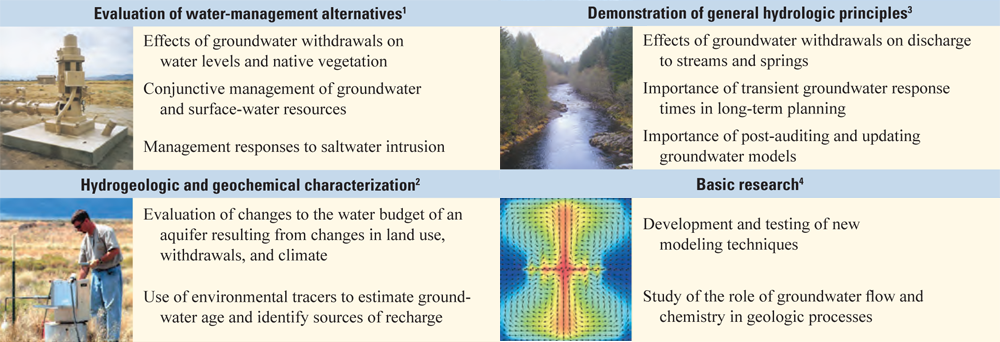
For more information, please see 1 Galloway and others (2003), 2 Reilly and others (2008), 3 Alley and others (1999), and 4 U.S. Geological Survey (2005). Photo and image credits, from the top: Loren Metzger, USGS; Mark Uhrich, USGS; Christian Langevin, USGS; USGS Office of Human Resources.
MODFLOW-2005
Features of an aquifer system that can be simulated by MODFLOW
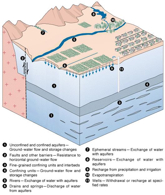
The modular finite-difference groundwater flow model (MODFLOW) developed by the U.S. Geological Survey (USGS) is a computer program for simulating common features in groundwater systems (McDonald and Harbaugh, 1988; Harbaugh and McDonald, 1996). The program was constructed in the early 1980's and has continually evolved since then with development of many new packages and related programs for groundwater studies. Currently, MODFLOW is the most widely used program in the world for simulating groundwater flow.
Simulation Capabilities of MODFLOW
MODFLOW is designed to simulate aquifer systems in which:
- saturated-flow conditions exist
- Darcy's Law applies
- the density of ground water is constant
- the principal directions of horizontal hydraulic conductivity or transmissivity do not vary within the system
These conditions are met for many aquifer systems for which there is an interest in analysis of groundwater flow and contaminant movement. For these systems, MODFLOW can simulate a wide variety of hydrologic features and processes. Steady-state and transient flow can be simulated in unconfined aquifers, confined aquifers, and confining units. A variety of features and processes such as rivers, streams, drains, springs, reservoirs, wells, evapotranspiration, and recharge from precipitation and irrigation also can be simulated.