California's Central Valley
The Role of Drilling in Groundwater Research
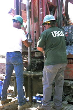
The USGS operates a full service research drilling unit for the express purpose of conducting exploratory drilling. The drilling team's role is to support research science projects and scientists while providing the highest quality data possible. USGS drilled well monitoring sites provide depth-specific data on groundwater levels, geophysical data on the alluvial deposits, hydrologic properties, water quality, and water chemistry from selected water bearing layers within a given aquifer system. This provides detailed geologic, geophysical, and hydrologic information that cannot be obtained from conventional water-supply wells.
Research drilling focuses on obtaining geologic samples and cores, running geophysical logs, and constructing or emplacing a variety of sampling devices and subsurface sensors.
Equipment & Capabilities
Multipurpose rigs allow each of our rotary rigs to perform any of the following drilling methods: air percussion hammer with or without advancing casing, air and mud rotary (direct or reverse circulation), auger, continuous wireline coring, and small diameter air reverse circulation.
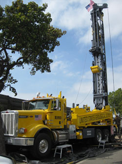
Mobility -- Anywhere in the US
Our units are totally self contained. Therefore, our mobility allows us to efficiently serve projects anywhere in the United States.
Borehole Geophysics
The USGS highly recommends collecting borehole geophysical data when drilling. Data from geophysical logging of boreholes is extremely valuable. The data can be used to determine instrument or well placement, help derive a 3-D model of geologic and hydrologic stratification, help determine aquifer water quality, and serve as a baseline for future water quality monitoring. Collection of geophysical logs along with drill cuttings from a borehole allows the scientist to correlate the data to other sites where perhaps only geophysical logs are available. Geophysical logging in monitoring wells over time is a proven method for tracking seawater intrusion and artificial recharge movement to name a few.